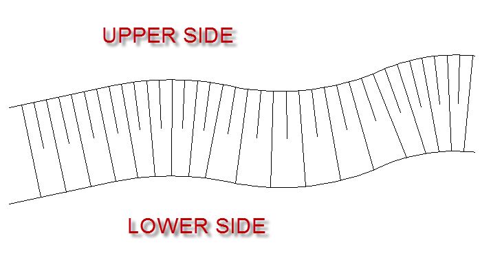
I often need to show grading for roads and ditches. This is what the map readers require and what the standard symbology for grading is. These 3D lines can be easily created in AutoCAD civil 3d and similar software but I would like to, if not create the same, then at least emulate these grading lines as 2D lines or symbology. Ideally, a polygon fill but that's unlikely to work effectively. I've also tried a number of techniques using hash line symbols and offsets but there are always issues with scale, etc.
Ultimately, I would like to be able to easily create such lines between to irregular lines. A link to a functioning script, addin, or an ArcObjects code snippet is acceptable.

