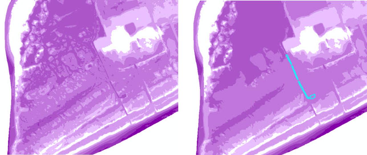
I'm using the Eliminate Polygon Part tool in ArcGIS to remove dry land surrounded by water (aka islands).
Tool Inputs:
Condition: AREA
Area: 50,000 Square Feet
Percentage: 0
Eliminate contained parts only: CONTAINED_ONLY
(There were no errors, the tool completed successfully)
It is my understanding, according to the Help, that by using this tool that any island 50,000 square feet or less will be absorbed by the polygon that is surrounding it (and therefore it will be "eliminated"). But, while that is happening, it seems something else is going on as well.
Actual polygons are being seemingly "removed" in the final output (which is weird in and of itself, because I didn't think this tool was supposed to remove actual polygons), but also, the output makes it appear that those polygons have been eliminated, when in fact, upon closer inspection, they are still there, "underneath" the larger polygons.
I'm confused. Is this supposed to be happening, am I misreading how to use this tool, or is this a bug? I could only really find two questions pertaining to this problem here and here, but no answer.
Image Descriptions:
The image on the left is the original feature class. The image on the left is after I run the tool. Upon investigation I found that areas that seem to have disappeared in the feature class on the right are actually there (e.g. area selected in blue). You can see the selected feature in the right-hand image in the image on the left, but you can only see it in the image on the right after I've selected it and it becomes highlighted. (I found these areas when multiple features were unexpectedly selected while using the Identify tool).

