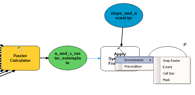
The output from Raster Calculator is a Raster Dataset. The input for Apply Symbology From Layer needs to be one the various layer data types (raster, feature, TIN, etc.):
In model or script use, the Symbology Layer most often comes from a layer file. The Make Feature Layer tool or the Make Raster Layer tool can be used to create a layer to apply symbology. Feature, raster, and TIN layers can also be created by right-clicking the layer in the ArcMap table of contents and clicking Save As Layer File. The layer is then saved in the desired location.
Since most GP tools output datasets, you'll have to make layers before applying symbology to them.
Alternatively, you can point the resultant dataset to a layer file and automatically add it the to map. Right click the parameter and check Add To Display and then select Properties -> Layer Symbology and choose your .lyr file. See here.

