0

I'm not sure if it's right place to do that but I am in a strong need of getting some help.

I am creating maps with lake bathymetry and there will be a lot of them. My task is to proceed the data from an echosounder, create a DEM raster layer and finaly visualise the data in an appropiate style. My client wants me to send him my final DEM layers with visualisation. It means that he just want to:

  • download my data
  • open it in ArcGIS or QGIS
  • and finally he wants this data to be already visualised.

Does anybody have an idea if this is possible?

He told me that we can make it via ArcGIS online but I think that in ArcGIS online i can upload only shapefile to my content.

3
  • Arc Online is more of a hassle than it's worth (if you or your client already has an ArcOnline organizational account and can take the hit on credits, then maybe it could work for you). Map packages from ArcMap are a great option, if you have a license. What specific component of the project do you need assistance with?
    – Tom
    Commented Jan 11, 2016 at 21:23
  • I'm unsure exactly what you are needing help with. It sounds like you either want a layer package or map package? What are you having problems producing?
    – MaryBeth
    Commented Jan 11, 2016 at 21:24
  • How about a 3d pdf?
    – TsvGis
    Commented Jan 12, 2016 at 0:46

3 Answers 3

1

you can do all of this using layer packages or map packages

1
  • Uploading map and layer packages to ArcGIS Online will only share the package, not create a map. I was surprised when it didn't create it since it has all the relevant information. A tile package would have to be created instead. Publish tiles Commented Jan 13, 2016 at 22:06
0

It is possible, if you use tiled map services. More here: ArcGIS Online - Publish Tiles If you use ArcGIS Online to create the tiles, there will be a cost in 'credits' to process them. You can do the processing yourself and publish it via Server if you aren't able to incur this cost. Here's some info on the cost in credits to create the tiles.

0

Thanks for your help!

I will try to check if map package will work.

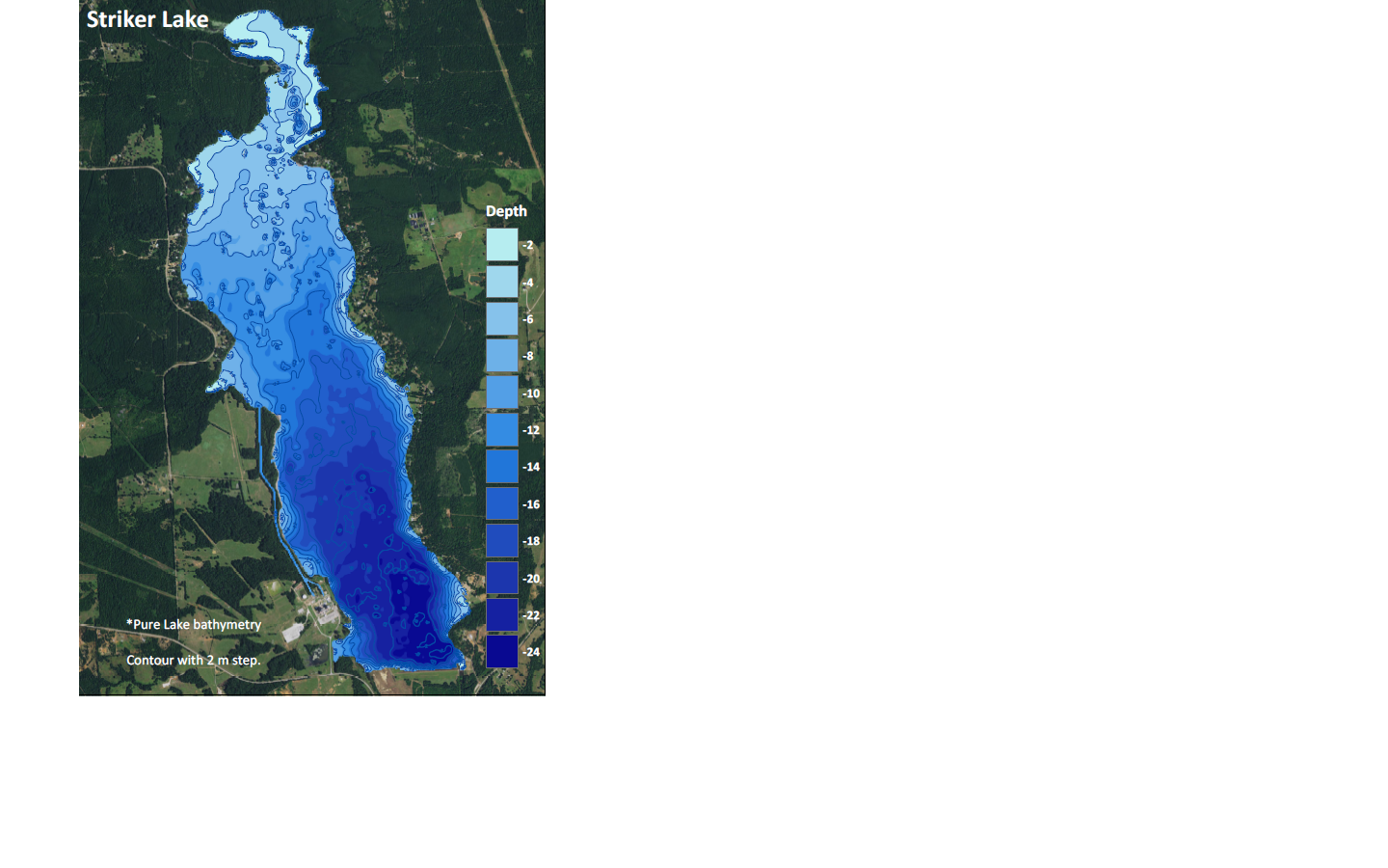
In the attachment you can find a sample of my work. What I really need is beeing able to send visualised lake bathymetry with contour layer in it. If I would send it as a raster, it will open in a default white-black colour scale and this is what I want to avoid.work_sample

1
  • As suggested by @Adam, you should also look into layer packages. They are much easier to handle, if you ask me. Unless you also need print layouts and such.
    – Martin
    Commented Jan 12, 2016 at 14:39

Your Answer

By clicking “Post Your Answer”, you agree to our terms of service and acknowledge you have read our privacy policy.

Not the answer you're looking for? Browse other questions tagged or ask your own question.