3

I'm looking for free (as in beer and as in commercial-use-friendly freedom) sources of stereo satellite imagery. I assume that such imagery should not be rectified since that would remove the benefits of having a stereo image pair, i.e. the geometry of the resulting images would be nearly identical.

So far I found a usable IKONOS dataset from the May 2008 China earthquake from the University of Maryland's Global Land Cover Facility (GLCF).

Do you know of any other stereo free satellite image sources besides GLCF?

3
  • 1
    Any location preferences?
    – Mapperz
    Commented Dec 12, 2011 at 16:20
  • @Mapperz: I need mainly mountainous locations.
    – Jaime Soto
    Commented Dec 12, 2011 at 21:49
  • Can you download them and maybe find someone who expertise in Remote Sensing or Image Processing Specialists who can do undo the recified satellite Imagery ? For my agency, we asked a private contractor who does the Aerial photos and we asked them to do unrecified aerial photos for us. They did and it really help our soil scientists. By the way, I have no idea of where there are free satallite imagery you are looking for. Goodl luck.
    – PROBERT
    Commented Dec 13, 2011 at 19:27

2 Answers 2

4

These probably aren't exactly the droids you're looking for, but the ASTER DEM is constructed using stereographic correlation. Hirano et al describe the process for creating the DEM using stereo pairs.

The only problem with ASTER is that its stereographic capabilities come from specific off-nadir tasked data collection. So unless you want to shell out big bucks, you're going to have to make do with whatever stereo pairs have already been collected.

The availability of ASTER data has also changed over time, I think because its a joint USA/Japan sensor. According to this page, you can get any L1B ASTER data from over the USA for free via the LPDAAC, but L1A and non-USA scenes are only available to certified NASA users through WIST.

I hope that helps!

3

[Rewritten]

For satellite imagery, the USGS Earth Resources Observation and Science Center is a good place to start looking. From that page, there are two special web portals you can use to search for satellite image tiles---Glovis and EarthExplorer. While they're similar, I tend to use Glovis for ASTER and EarthExplorer for Landsat. But I believe they are nearly equivalent.

No matter how you approach your search, the key to achieving stereo parallax is overlapping exposures from different vantage points. So focus on identifying nearly cloud-free tiles with overlap in your area of interest.

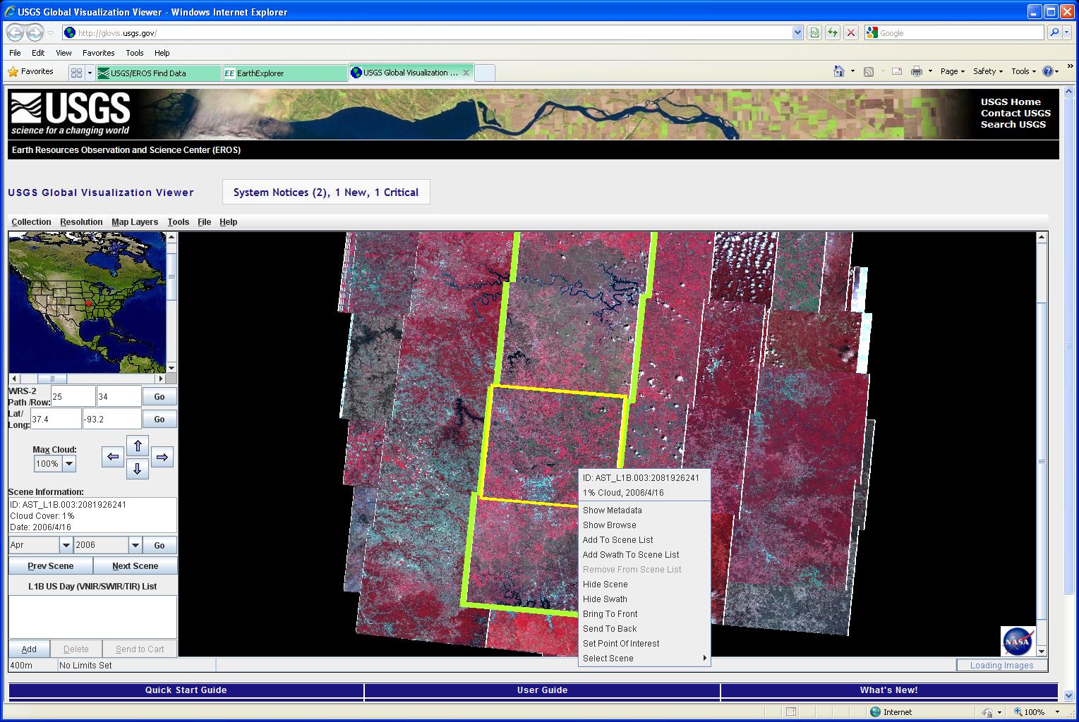
In this Glovis screenshot I'm searching ASTER imagery. You can distinguish areas of overlap between the tiles, and it stands to reason that you could achieve stereo parallax from either 1) sequential tiles along any flightline, 2) neighbor tiles from a parallel flightline, or 3) exposures for the same position from different times. However I'm not 100% sure about that third suggestion. While exposures from different times should create stereo parallax (the satellite doesn't pass through the exact same position), I suspect it may be impossible to perceive.
enter image description here

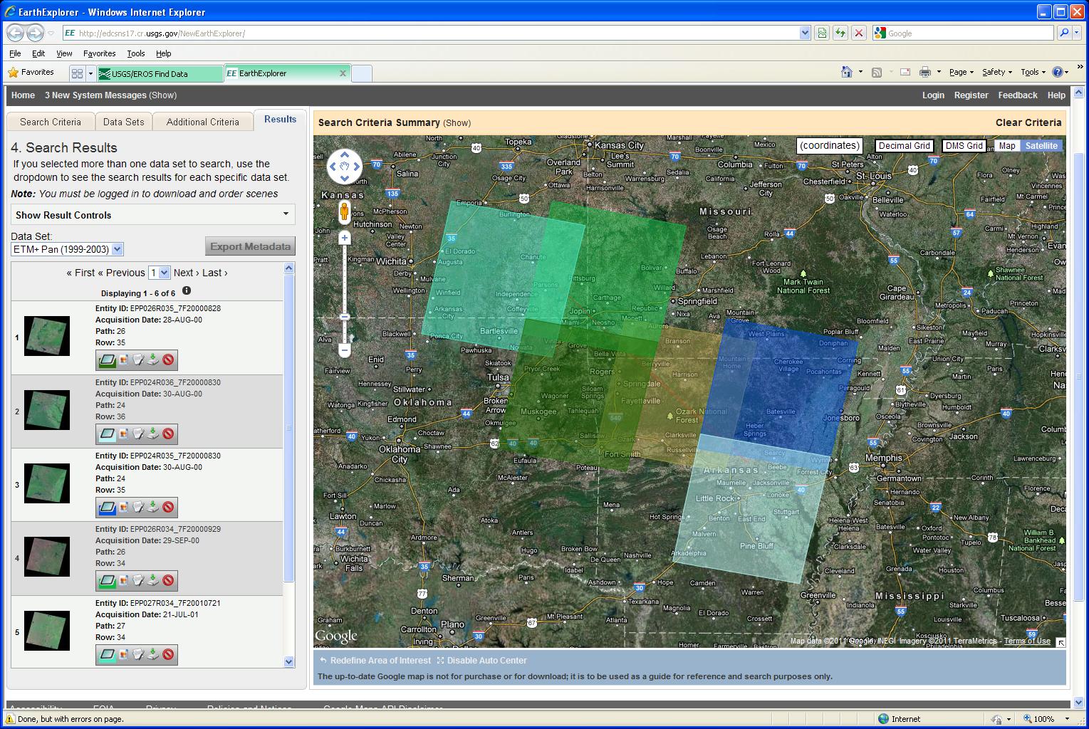
Similarly, in this EarthExplorer screenshot, I'm searching Landsat imagery. The same principals apply; although, because the swaths are wider, it may be difficult to find overlapping tiles for an exact area of interest.
enter image description here

0

Your Answer

By clicking “Post Your Answer”, you agree to our terms of service and acknowledge you have read our privacy policy.

Not the answer you're looking for? Browse other questions tagged or ask your own question.