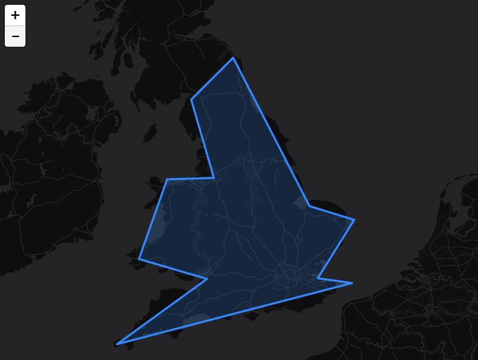
I am trying to get a GeoJSON with projected coordinates to show in Leaflet.
I have no problems loading GeoJSON with lat/lng (EPSG:4326). Here is a fiddle where I load the GeoJSON with unprojected lat/lng.
I am using the Leaflet 1.0.0-beta.2 (954e83d) in the fiddle but I am happy to use another version.
I am aware of the coordsToLatLng method of L.geoJson but no idea how to make this work.
This is the GeoJSON with the projected (EPSG:3857) coordinates.
{
    "type": "FeatureCollection",
    "crs": {
        "type": "name",
        "properties": {
            "name": "urn:ogc:def:crs:EPSG::3857"
        }
    },
    "features": [{
        "type": "Feature",
        "properties": {

        },
        "geometry": {
            "type": "Polygon",
            "coordinates": [[
            [-625570.6, 6465993.0],
            [-305006.9, 6696510.8],
            [-546330.2, 6768547.6],
            [-445478.6, 7053093.0],
            [-279794.0, 7056694.8],
            [-359034.5, 7337638.4],
            [-211359.0, 7485313.8],
            [62380.8,   6955843.3],
            [220861.7,  6909019.4],
            [91195.5,   6700112.6],
            [213658.1,  6682103.4],
            [-625570.6, 6465993.0]]]
        }
    }]
}
Notes: I am new to Leaflet. I come from a GIS background. I have a very good understanding of projections and transformations. I have a very good understanding of OpenLayers3. I use OL3 to do things such as this on a daily basis. The data in this post is obviously just an example. I am trying to learn Leaflet in order to compare the performance with OL3. I know how to use QGIS and can unproject the data manually but this is not the point of this post.
This is not a repost. I have checked every bit of information on coordsToLatLng but didn't find any good documentation and nothing like a working example. Certainly no fiddle.
Just saying this as I have read a lot of Leaflet posts on gis.stackexchange with half-a-code. And a lot of answers which suggest to change the data. I know that Leaflet is not a GIS system and the makers are not from a GIS background. In the last hour I have just read a lot of rubbish about Leaflet using EPSG:3857 as default SRS and WGS84 being an SRS.

