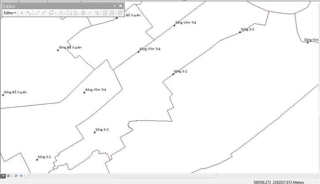
As you can see in the pic below i have some points "Sông Vĩnh Trà". Their Geometry type are Multipoints. They are parts of a river, so i want to connect them to display the river on the map. I tried to search for "connecting Multipoint arcgis" but i still can't find solution.
-
Have they been created in order? How many points are there?– Midavalo ♦Commented Apr 16, 2016 at 5:47
-
have 6 point "Sông Vĩnh Trà" on the map. i want to connect them to display as a river XD– Phúc HoàngCommented Apr 16, 2016 at 6:18
-
@Midavalo or do you know how to display them as a line without connecting them ? i'm newbie, this is the first time i work with mutipoints geometry :3– Phúc HoàngCommented Apr 16, 2016 at 6:20
-
create a line feature class and draw a line connecting the 6 points? I'm unsure what else you're trying to do here - multipoints won't display as lines. If they are created in order you could potentially script it to draw a line from vertex to vertex (or point to point) but if there are only 6 points it would be much easier to just draw it yourself– Midavalo ♦Commented Apr 16, 2016 at 6:24
-
Nah thank you @Midavalo. I thought about drawing a line but i just wonder if have other ways. ^_^– Phúc HoàngCommented Apr 16, 2016 at 6:42
2 Answers
As there are only 6 points, I'd suggest you just create a new line feature-class and draw the line connecting the 6 points.
Multipoints won't display as lines. If they are created in some kind of identifiable order, it could be scripted to draw the line from vertex to vertex (or point to point), however for so few points it's not likely to be worth the effort.
Assisted by comments from @Midavalo, I now know that multipoints won't display as lines so i will create a new line feature class and draw a line to connect them.

