3

I have a shapefile of about 62.000 polygons. I calculate the area of each polygon on a field, named AREA1, with Calculate Geometry option. Secondly, I create a new field field named AREA2. I calculate the are of the polygon from Field Calculator, using the code:

!shape.area!

Finally, I check if the fields AREA1 and AREA2 are equal. In 30 polygons there are tiny differences.

Does anyone can explain why is this happening?

3
  • 1
    Are the properties of the number field identical? Maybe there is some rounding? Commented May 18, 2016 at 7:53
  • 1
    please give examples of the "tiny differences"
    – Midavalo
    Commented May 18, 2016 at 8:37
  • Both fields are identical Double with Precision 0 and scale 0. The differencies are smaller than 0,01 of square meters.
    – Panos
    Commented May 18, 2016 at 9:00

2 Answers 2

1

I was able to reproduce this effect, although I had to end up using the code:

!shape.area@squaremeters!

I got the following results in my table, with both fields being identical like you stated:
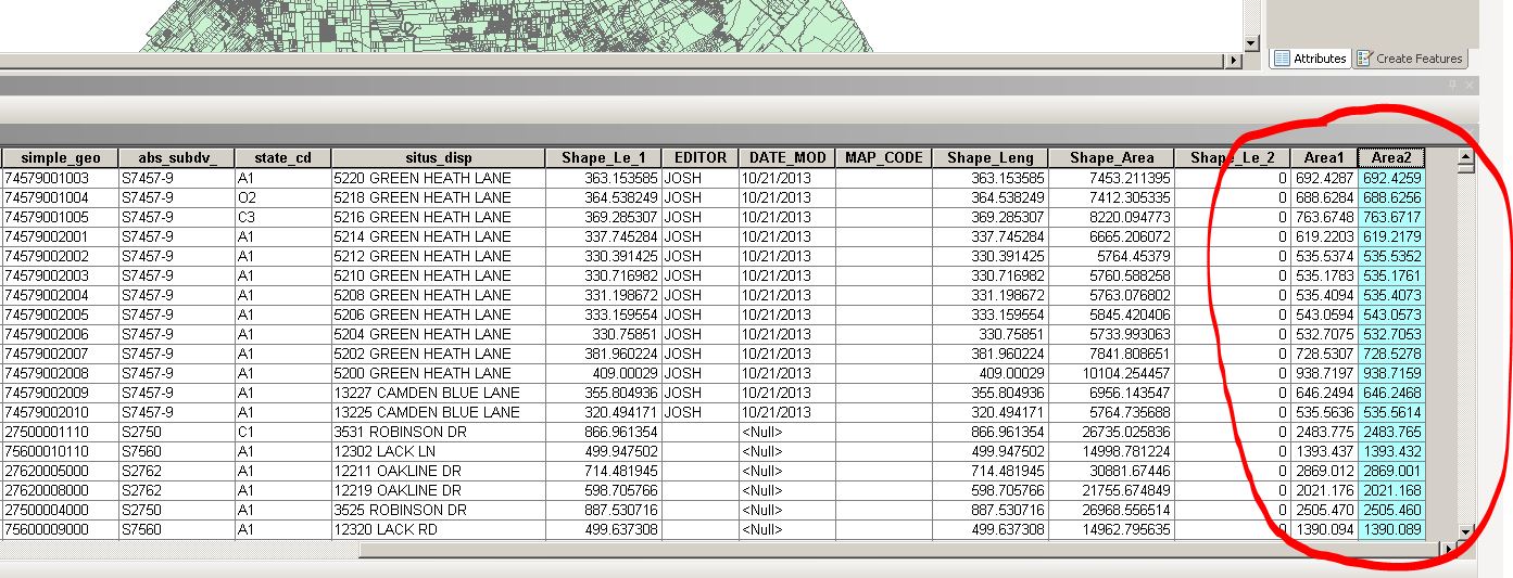
enter image description here

Reading into the help guide, it looks like it could be an issue with the fact that the "Calculate Geometry" tool lets you utilize the coordinate system that your data is currently in, whereas the "Field Calculator" tool utilizes geodesic algorithms to calculate the area and apparently ignore your Geographic Coordinate System. See the Note and Caution below:
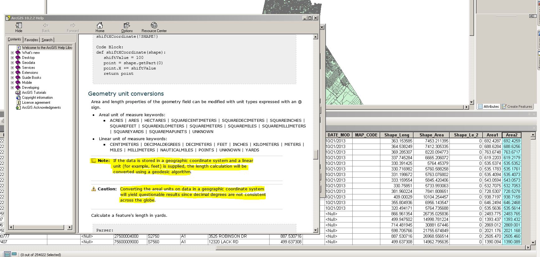
enter image description here

For this reason, it would appear that ESRI is telling us that the "Calculate Geometry" tool would be more precise for this operation because it utilizes your specific coordinate system and not an algorithm that has been created for global use.

After some digging, I really don't see a way around this.

1
  • Thanks for the detailed response. The thing is that after posting my question I tried to make the same calculation with and without defined Projection (Greek Grid) and the problem remains the same!
    – Panos
    Commented May 19, 2016 at 6:19
0

I might expect the results for area calculated in the projected space to be different from those using geographic coordinates. It just depends what areas the tool claim to compute. Consider the "square" whose corners are at the UTM coordinates 18n 528007 4467447 18n 528008 4467447 18n 528008 4467448 18n 528007 4467448

It might be plausible to assign this an area of 1 m2. However the "meter" here is a projected meter and because the scale of UTM at the center of this square is 0.999609655636. The real area is in fact very close to 1/0.9996096556362 m2 = 1.000781146072 m2.

I would hope that the ARCGIS documentation would explain this. Furthermore it's certainly possible to compute the area on the ellipsoid accurately (without converting the points into a projection). Thus the statement that "converting the areal units on data in a geographic coordinate system will yield questionable results since decimal degrees are not consistent across the globe" means either that that ARCGIS is using an inaccurate algorithm for the area calculation or that the author of the documentation is confused.

Your Answer

By clicking “Post Your Answer”, you agree to our terms of service and acknowledge you have read our privacy policy.

Not the answer you're looking for? Browse other questions tagged or ask your own question.