1

I have two point layers, each containing one column of values.

When using the graduated style in layer properties, the size of the points is relative to the total range of values within that layer . Classification (natural jenks) breaks the value range into certain intervals, they are assigned sizes, and that is what you get.

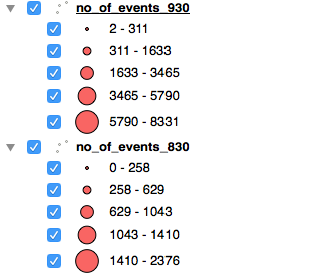
However, when you have different ranges, the circle sizes become meaningless when represented on the same map. For example:

enter image description here

Here, we see the same circle sizes representing different value ranges. How can I make circle size (or radius) in layer properties a function of the actual value assigned to the point, as opposed to classifying the values into intervals which are then assigned sizes?

1 Answer 1

1

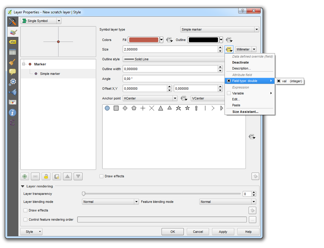
You can use a data-defined override in the properties of your marker to make the size of the marker dependent on a field, variable or expression:

Data-defined override

2
  • thank you, but how would one then add a scale below that explains the size of the smallest point and the largest point? Commented Jun 30, 2016 at 12:50
  • It's not easy but there are some tricks here. On solution would be to create a fake layer with some sample points and use a categorized symbology.
    – thibautg
    Commented Jun 30, 2016 at 12:56

Your Answer

By clicking “Post Your Answer”, you agree to our terms of service and acknowledge you have read our privacy policy.

Not the answer you're looking for? Browse other questions tagged or ask your own question.