1

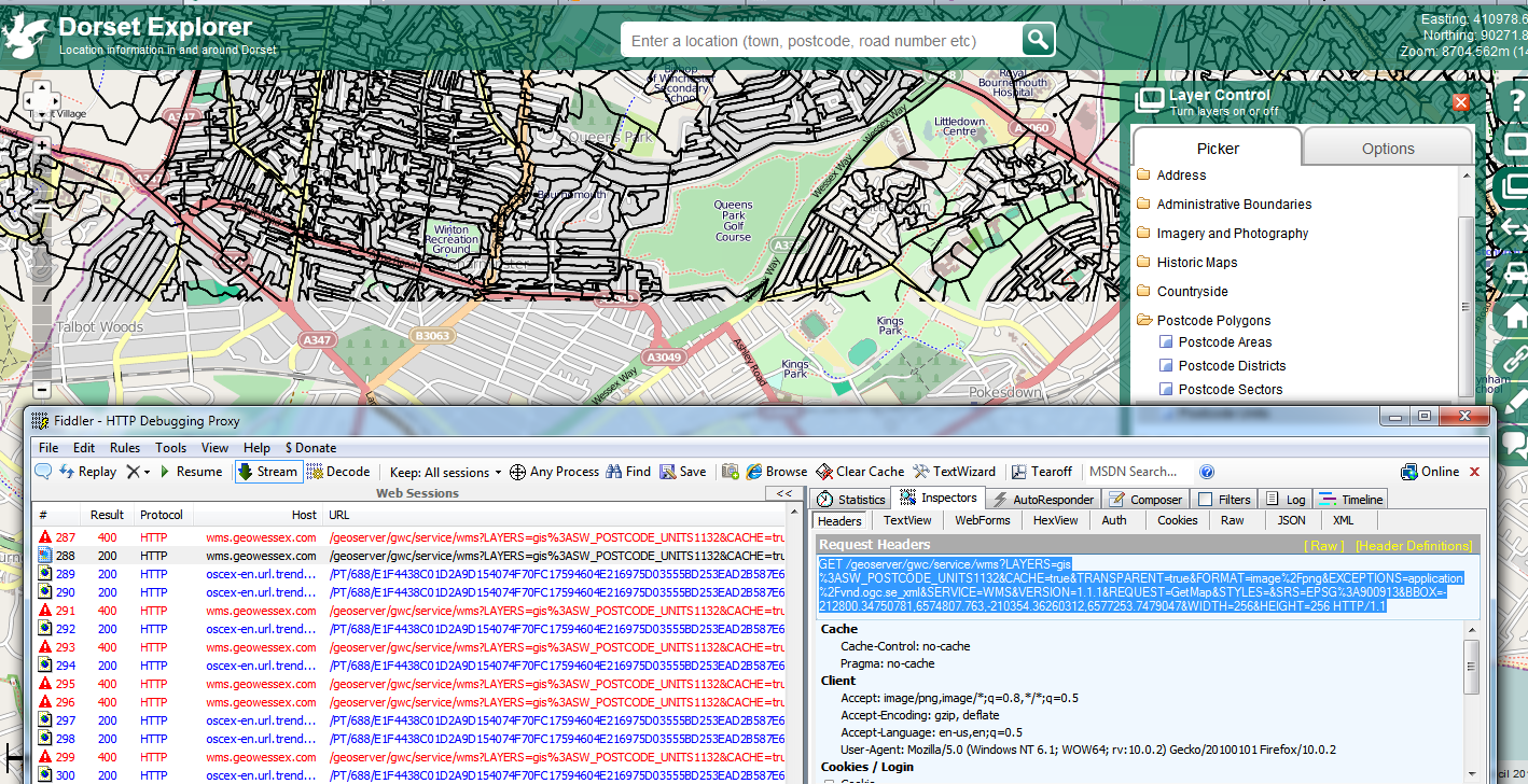
We are having some intermittent faults with GeoServer at the moment. We have a mapping application - http://explorer.geowessex.com - that makes WMS requests to our Geoserver to retrieve tiles. The layers are properly loaded and work via GeoServers built in 'Layer Preview' function, but sometimes in the application the tiles don't load. In the Firebug Net Panel you will see all the WMS Get Requests being fired when a layer is loaded and they say they return with no errors. In reality if you open one of these response in a new tab you get the following XML file.

<?xml version="1.0" encoding="UTF-8" standalone="no"?><!DOCTYPE ServiceExceptionReport SYSTEM "http://wms.geowessex.com:80/geoserver/schemas/wms/1.1.1/WMS_exception_1_1_1.dtd"> <ServiceExceptionReport version="1.1.1" ><ServiceException code="LayerNotDefined">
  Could not find layer 'workspacename':'layername'

Which is stupid because it definitely exists, I can see it load perfectly well in GeoServer layer preview. What's even more annoying is that sometimes it doesn't even return this, it just gives the error '400:Problem communicating with GeoServer'. On top of that I cannot reproduce it regularly, I can have the map up, turn on a layer and it wont work. Turn on another layer and it will, go back and turn the other layer back on and it will start working again.
I'm really banging my head against a brick wall here. GeoServers own documentation is not that good for troubleshooting and I must've done enough Google searches to bring down their servers in the last two days and am still no closer as to why this happens.

Anyone experienced this themselves?

2 Answers 2

2

The problem turned out to be in the 'security' folder in our GeoServer data directory. One of the files must have been corrupted as when we put a clean version of this back in everything started working again. Strange one though. We don't know how it got corrupted or which file got corrupted.

1

Set your GeoServer seeding option to 'Reseed' - I have used fiddler2 can see the good responses and the bad - this should stop this issue by forcing the server to do a full request for each tile. The overhead is a slower map/layer refresh.

Good Mapping Application though. Clean and lots of layers available.

Side note: I expect/hope you have an enterprise (from GeoPlan?) license for showing Postcode units/sectors/districts on a web application. Acknowledgement is also required on the map.

enter image description here

3
  • [pedantic mode] Cartographically navy blue or purple [#23238E or #58238E] would be a better choice for Postcode colours rather than black on the OSM background.
    – Mapperz
    Commented Feb 23, 2012 at 18:03
  • As this service contains lots of Ordnance Survey data would advise that it uses https - wms.geowessex.com/geoserver/gwc/service/… has no watermark or anti-copy control - would be easy to scrape that data.
    – Mapperz
    Commented Feb 23, 2012 at 22:07
  • +1 as this may help someone else but sadly it is not our issue. We have got our IT team looking at the network to see if there are any choke points/proxy authentication issues. It may also just be the pure number of requests coming in as they have spiked dramatically recently. On your pedantic point I agree but I only loaded this layer recently and havent had time to update the style. We have all the relvant licenses to display OS Data on our web app. The acknowledgement should appear in the bottom right, but Ive just spotted this is set wrong, so I'll sort that :) I'll keep you updated Commented Feb 27, 2012 at 10:09

Your Answer

By clicking “Post Your Answer”, you agree to our terms of service and acknowledge you have read our privacy policy.

Not the answer you're looking for? Browse other questions tagged or ask your own question.