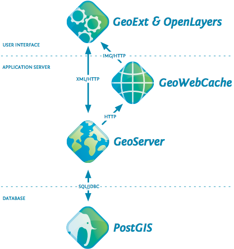
I am completely new to GIS and therefore have questions regarding how the GIS Web development should be made, because the entire concept still confuses me.
So, imagine I have a map. And by this, i mean the shape files for the layers and so on.
How i should i use this in my web application?
I have read about MapServer, OpenLayers, PostGIS, but can't quite understand how and why this all enters the question.
If i have my map, my files, shouldn't the problem be just on to represent it in the web page?

