3

I am trying to line-up road data from Korea's transportation bureau with my basemap in ArcGIS, but the road shapefile and basemaps are not lining up. I am using the coordinate system for the road data ("KoreaRoads" shp file below). The top right portion of the first screenshot is the "readme" file that came with the road data. That page is talking about the coordinate system for the data-set...
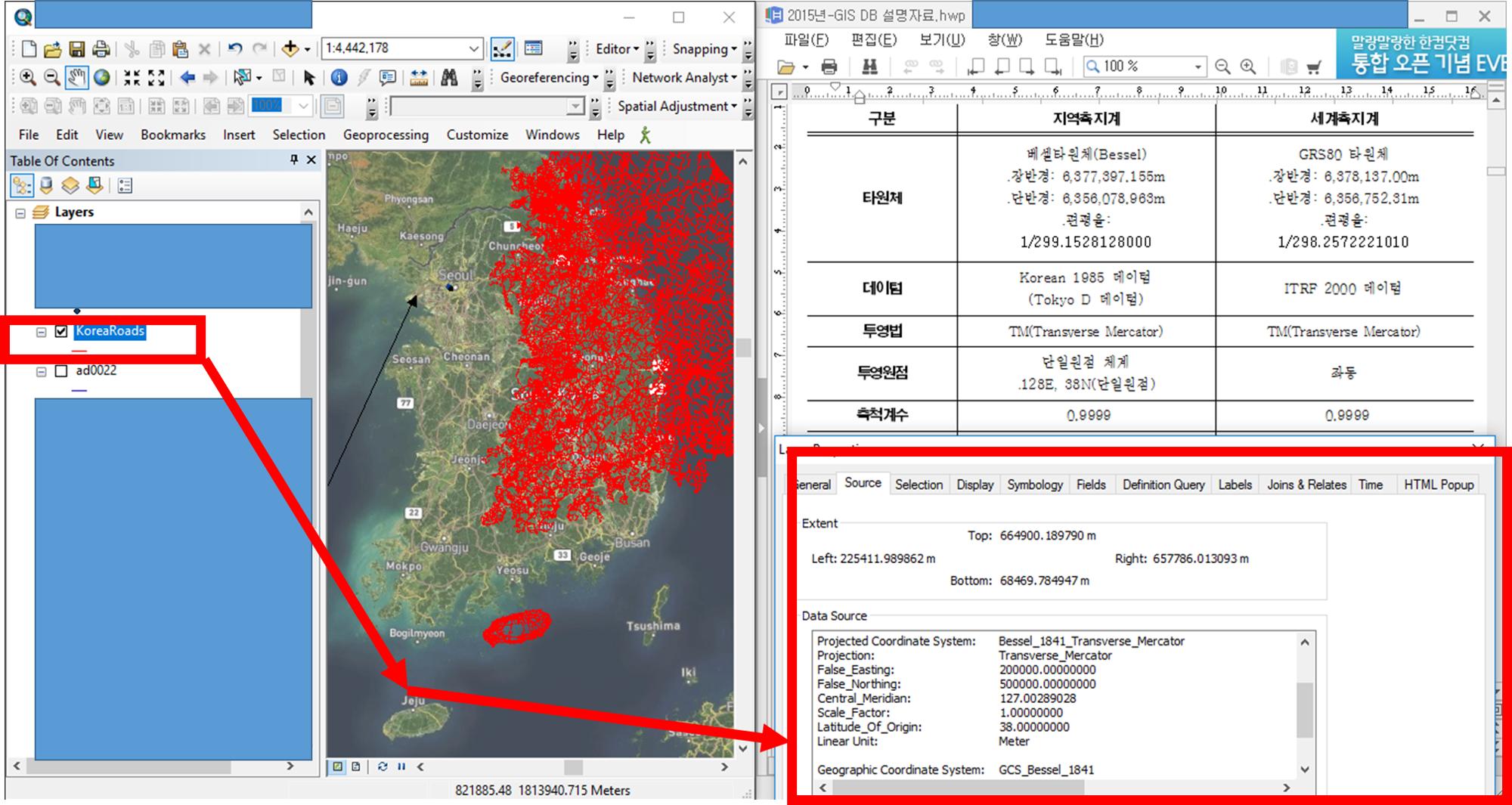
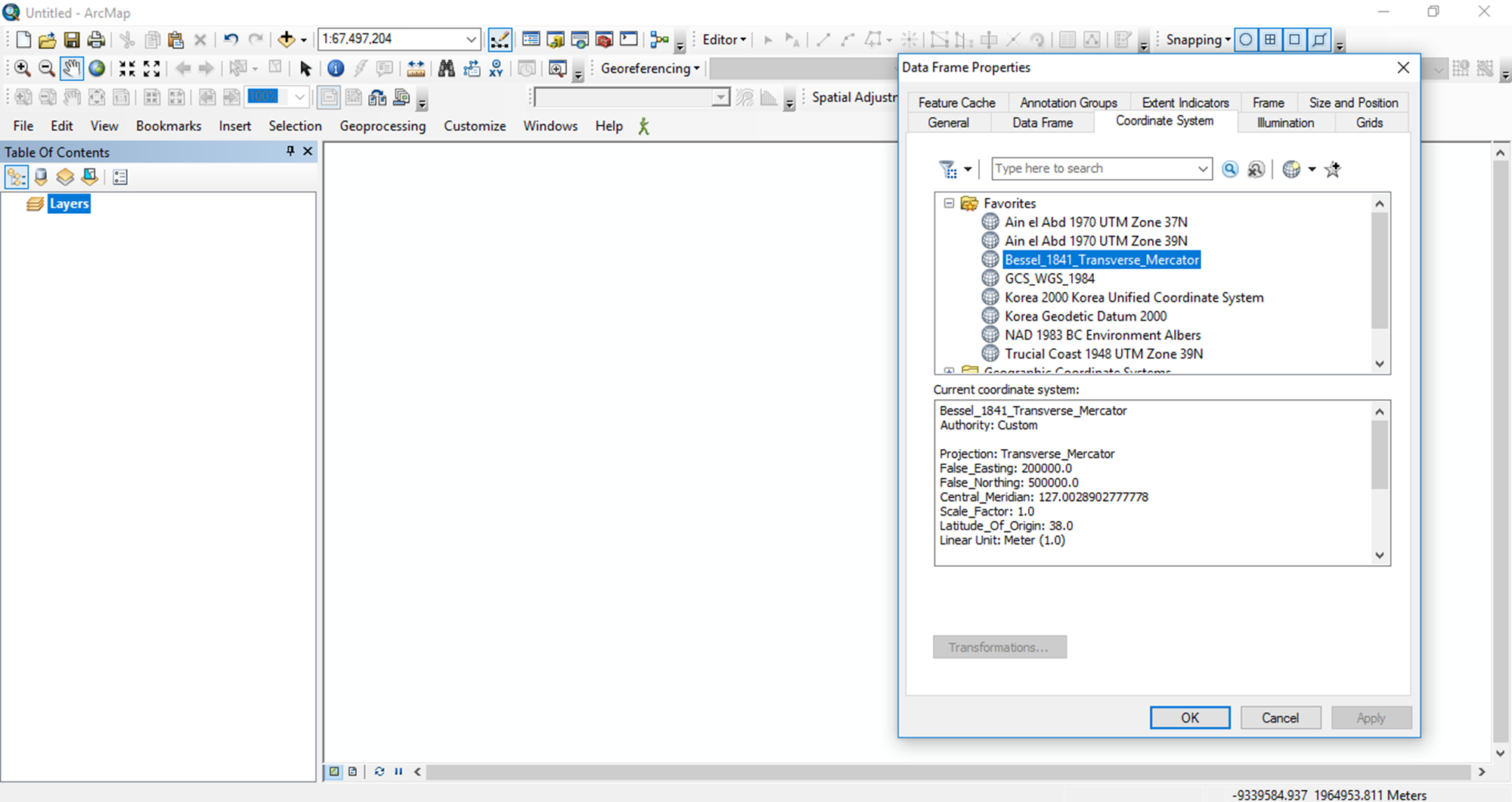
enter image description here ​ Even when I make a new map and set everything to the coordinate system that the transportation bureau requests, "Bessel", their road file still does not match up with the basemap. Please see screenshots below:
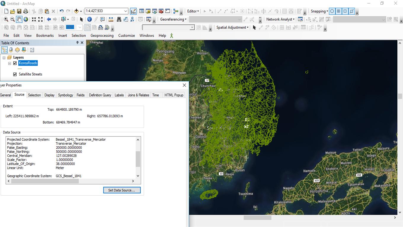
enter image description here

enter image description here ​ As you can see the road files do not like up in South Korea at all...I am a bit confused about why this might be despite me ensuring the coordinate systems match with what the Transportation bureau is saying.

1
  • I think Alex is on the right track that you're using the wrong coordinate reference system. However, all the South Korea CRS that are supported by ArcGIS use either 0.9996 or 1.0 for the scale factor, not 0.9999. Anyway, maybe we can get close. Strip any coordinate system off the roads data. You can do this by setting the CRS to "none" or "clear" it. Add it to ArcMap with the base map. Set the data frame properties to likely candidates like the Unified Coordinate System in pcs - national grids - south korea folder. If you can get the roads to line up, you've found the CRS.
    – mkennedy
    Commented Nov 10, 2016 at 20:00

1 Answer 1

3

I don't think you're using the right coordinate system.

I note that there are two columns in that sheet, and although I can't read Korean, I can see two references to different spheroids or datums.

Reading here describes the old one (that you're using, Bessel) and a new on (the Geocentric Datum of Korea.)

Here's a link to the EPSG for the CRS to try: https://epsg.io/6737-datum

And for reference, the old one: https://epsg.io/6162-datum

So, have a go setting up your layer with the coordinate reference system defined as EPSG:6737.

2
  • thanks so much for your feedback. I tried over the past two days to figure out how to create a new coordinate system for EPSG:6737 using the info in the link you sent by Google searching "How to install a GML ArcGIS" and asking a friend of mine for help, but with no luck. Would you happen to have any feedback on importing/installing the EPSG:6737 as per your suggestion? Any feedback (or possibly a Google Hangouts/Skype?) on how to do this would most definitely be appreciated ^^ Thank you again for taking the time to provide your initial feedback!! Ray
    – Ray
    Commented Nov 10, 2016 at 4:25
  • 1
    Have a look here: gis.stackexchange.com/questions/23155/… or perhaps ask another question. I'm not sure how to set up a custom coordinate reference system in ArcMap.
    – Alex Leith
    Commented Nov 14, 2016 at 5:29

Your Answer

By clicking “Post Your Answer”, you agree to our terms of service and acknowledge you have read our privacy policy.

Not the answer you're looking for? Browse other questions tagged or ask your own question.