0

I have a DTM file (created from OS terrain data) which I would like to split into 4 smaller files, based on the features in a polygon shapefile, in order to perform further processing in ArcScene and ArcMap.

I am using Data Management Tools --> Raster --> Raster Processing --> Clip to clip the .tif file.

However, the output of the smaller DTM does not exactly match up with the input polygon feature, as shown here:clip example
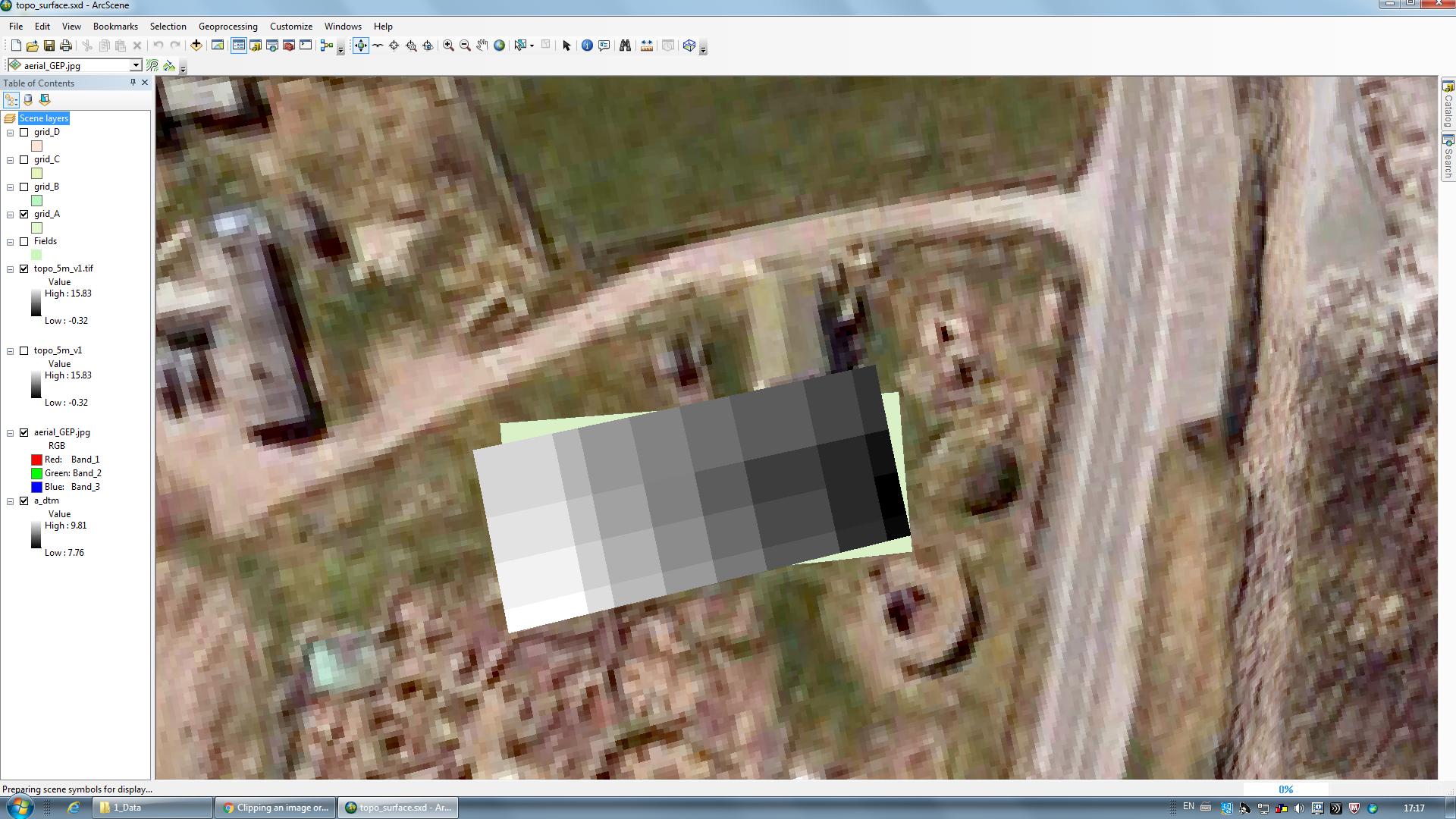
I have tried other methods (i.e. split) and also tried in QGIS but I still get the same problem.

Can anyone suggest why this is happening and help me navigate around it?

1 Answer 1

1

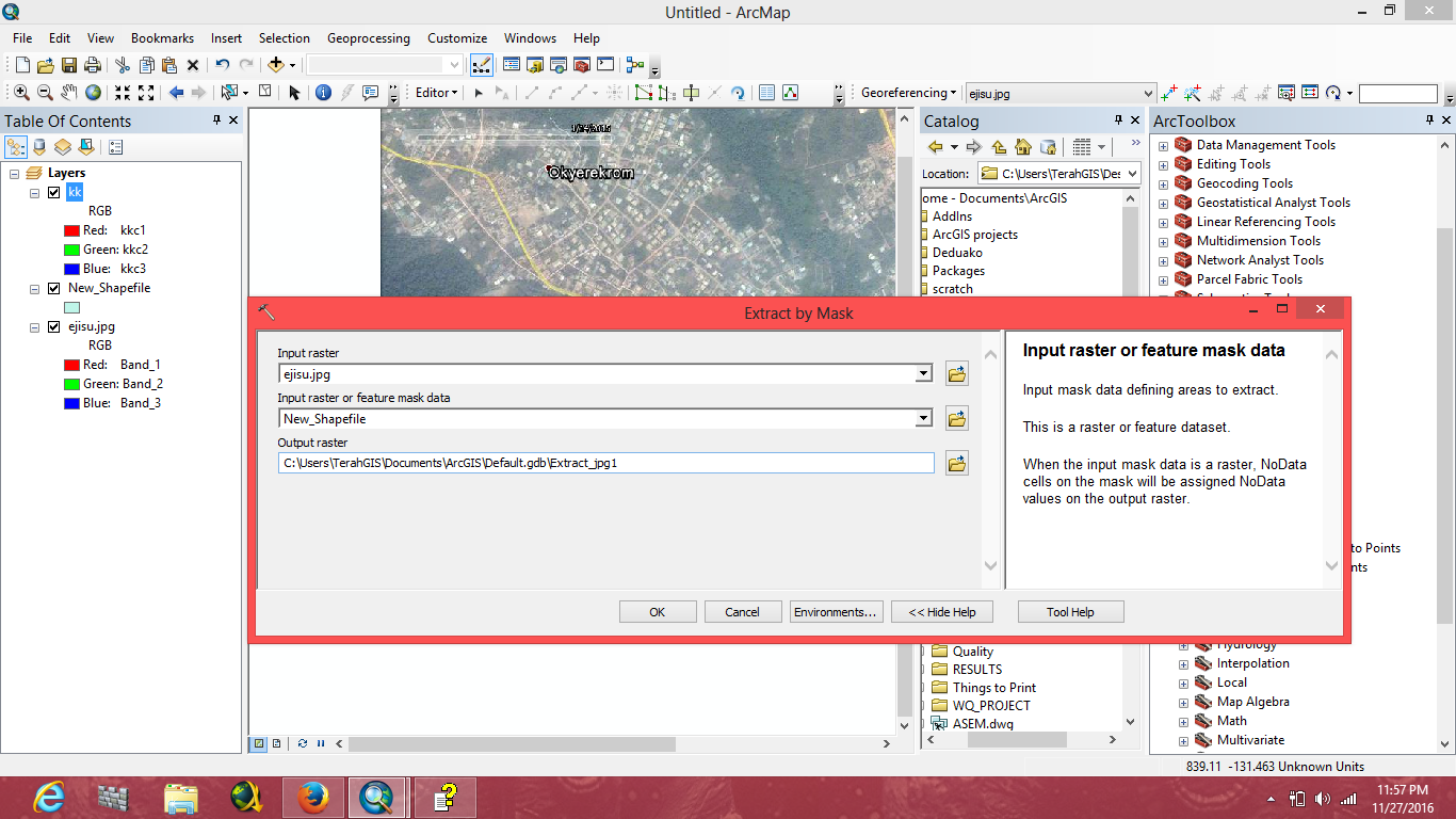
In Arcmap, create a shapefile with polygon as feature type(you can assign a cordinate system if the source of DTM is known). Bring the Editor toolbar by going to "Customize","Toolbars" and click on "Editor". Go to the drop down of the Editor Menu and click "Start Editing". Click on "Create Features" ,and Select "Rectangle". Draw it on the desired spot on the Raster. Go to "ArcToolbox", "Spatial Analyst Tools" and select "Extraction by Mask". Input Raster, and select the shapefile layer as "Mask".

enter image description here

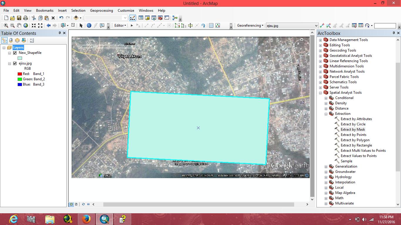
Here is how the Rectangle can be drawn on the Raster.

enter image description here

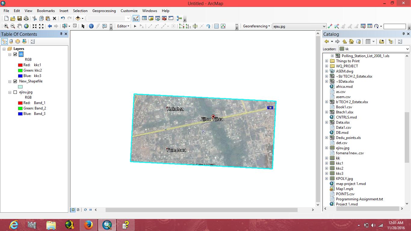
Here is how the output will look like.

enter image description here

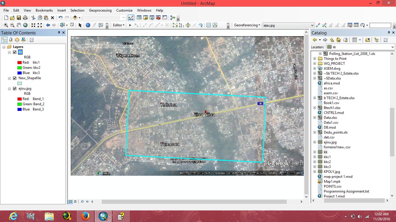
clipped Raster Image correctly aligned with the main image source.

enter image description here

Your Answer

By clicking “Post Your Answer”, you agree to our terms of service and acknowledge you have read our privacy policy.

Not the answer you're looking for? Browse other questions tagged or ask your own question.