1

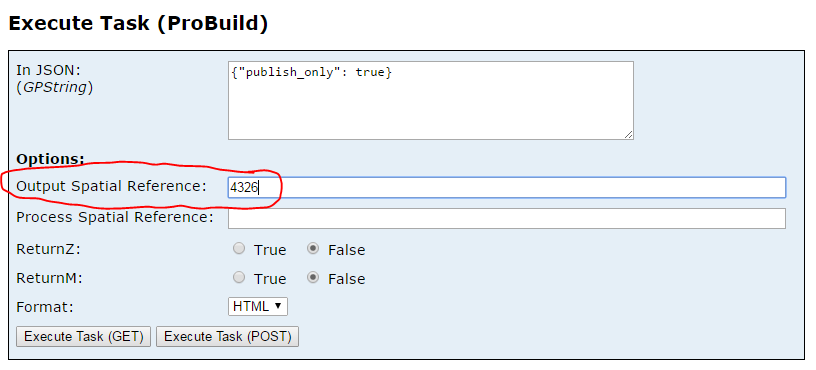
I know I could just create a custom parameter but it seems there's already a built in method here to specify the output spatial reference - I just have no idea how to read it.

I've tried checking arcpy.env.outputCoordinateSystem but it's null at runtime.

enter image description here

2
  • Why do you need to read it? I'm 99% sure you cant read it due to how the gp service framework it setup. But it does what it's supposed to: return the final geometries in whatever spatial ref you've set.
    – KHibma
    Commented Jan 27, 2017 at 15:04
  • @KHibma There are occasions where you need more than just a black box framework. I suppose we're using a technically unsupported workflow by packaging and returning json ourselves (relying on the framework to package layers added a very noticeable and unacceptable amount of overhead). I can see your point for our case, but I can imagine there are likely some other situations where it'd be good to read that information without just trusting it will be done.
    – Josh Werts
    Commented Jan 27, 2017 at 19:19

0

Your Answer

By clicking “Post Your Answer”, you agree to our terms of service and acknowledge you have read our privacy policy.