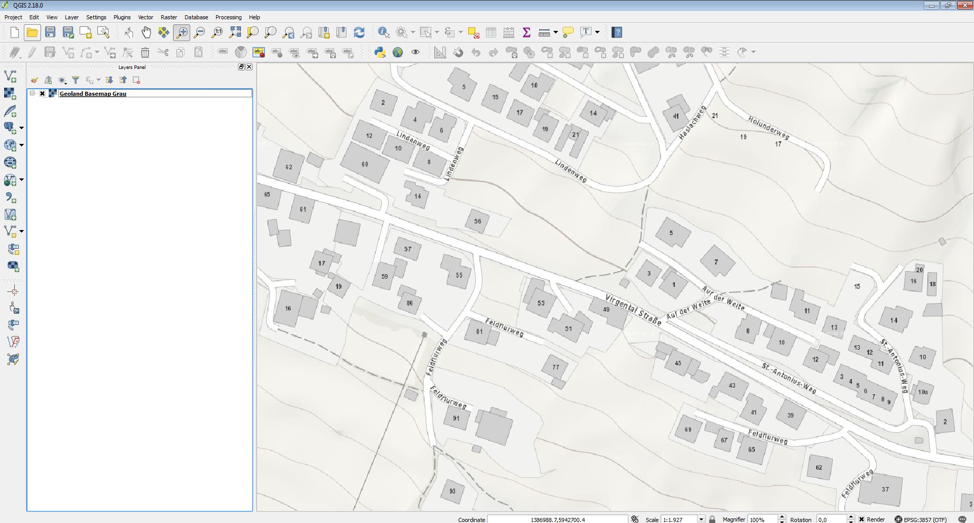
Using ArcGIS Pro (1.4) and QGIS 2.18 I discovered that both programs have a different "display-quality" of the same WMTS-Service (in my case basemap.at - the map called basemap-grey). I was surprised and checked some properties, but with no success. ArcGIS Pro seems to render it "smoother" (Screenshots attached). In both programs I tested it with the same extent at the same scale (and EPSG 3857 as data-frame SRS). In QGIS I manipulated some resampling-parameters, but without getting the same quality.
Does someone know how to improve it ?


Add a comment
|
1 Answer
Looks like the problem is related to the pre-defined scale levels by QGIS (Settings - Options - Map Tools). Defining your own levels for basemap.at like described here works well. Alternatively the Tile Map Scale PlugIn does the same job.
