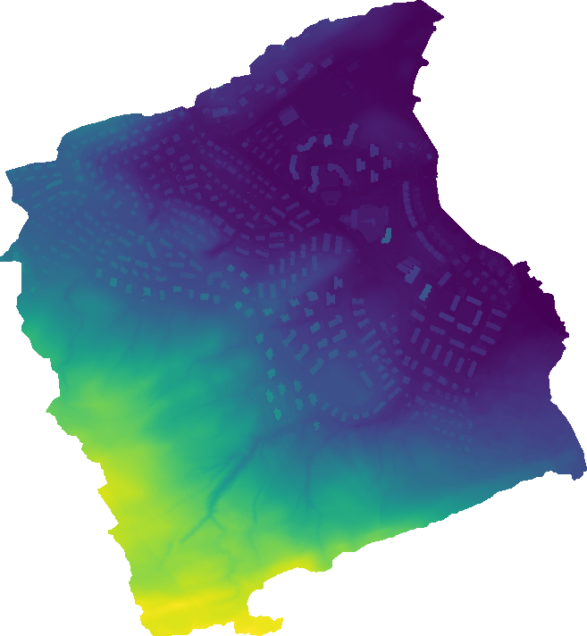
I need to export a raster I produced with GRASS. The Map Display portraits this raster like this:
The metadata of this raster also looks pretty normal:
> r.info map=blenddem
 +----------------------------------------------------------------------------+
 | Map:      blenddem                       Date: Fri May  5 11:35:05 2017    |
 | Mapset:   DEMs                           Login of Creator: desouslu        |
 | Location: Luzern                                                           |
 | DataBase: /home/desouslu/maps/grass              |
 | Title:                                                                     |
 | Timestamp: none                                                            |
 |----------------------------------------------------------------------------|
 |                                                                            |
 |   Type of Map:  raster               Number of Categories: 0               |
 |   Data Type:    DCELL                                                      |
 |   Rows:         3369                                                       |
 |   Columns:      3110                                                       |
 |   Total Cells:  10477590                                                   |
 |        Projection: CH1903+ / LV95                                          |
 |            N:   210553.5    S:     208869   Res:   0.5                     |
 |            E:     668202    W:     666647   Res:   0.5                     |
 |   Range of data:    min = 430.691497802734  max = 600.981266929298         |
 |                                                                            |
 |   Data Description:                                                        |
 |    generated by r.patch                                                    |
 |                                                                            |
 |   Comments:                                                                |
 |    r.patch input="tmp_3151920,uavdem" output="blenddem"                    |
 |                                                                            |
 +----------------------------------------------------------------------------+
I am using r.out.gdal to export this raster, and apparently everything goes on fine:
> r.out.gdal input=blenddem output=/home/desouslu/maps/blenddem.asc format=AAIGrid --overwrite -c
Driver <AAIGrid> does not support direct writing. Using MEM driver for
intermediate dataset.
Checking GDAL data type and nodata value...
 100%
Using GDAL data type <Float64>
Input raster map contains cells with NULL-value (no-data). The value -nan
will be used to represent no-data values in the input map. You can specify
a nodata value with the nodata option.
Exporting raster data to AAIGrid format...
 100%
r.out.gdal complete. File
</home/desouslu/maps/blenddem.asc> created.
However, the resulting raster is actually empty:
> cat /home/desouslu/maps/blenddem.asc
ncols        1
nrows        1
xllcorner    0.000000000000
yllcorner    0.000000000000
cellsize     1.000000000000
NODATA_value  -nan
 -nan
What is exactly going on here? Am I using r.out.gdal incorrectly?


g.region raster=blenddem?