3

I have a subscription to Nearmap that provides me with WMS Server link to their images. I would like to perform image classification using this imagery however I can't work out how to use the WMS feed for classification in ArcGiS (v10.3.1) short of exporting a series of maps as a raster.

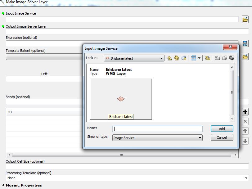
I've tried Arc's "make image server layer" tool however I can't seem to select an image service layer. I get to the point in the attached image and can't select anything.

Does anyone know how I do this?

can't select image service layer

1
  • Can you use the WMS to download a layer image then work on that image as a standalone data source?
    – nmtoken
    Commented Sep 14, 2017 at 6:45

1 Answer 1

1

The Make Image Server Layer tool:

Creates a temporary raster layer from an image service. The layer that is created will not persist after the session ends unless the document is saved.

but it sounds like you have a WMS and not an image service so I think you should try the help for Adding WMS services instead because it describes how:

WMS server content can be used in ArcMap (as well as ArcGlobe) as map layers.

Your Answer

By clicking “Post Your Answer”, you agree to our terms of service and acknowledge you have read our privacy policy.

Not the answer you're looking for? Browse other questions tagged or ask your own question.