4

I started with a line vector file consisting of several creeks. The problem with that file was that most of the creeks within the file were broken illogically into segments, even those that should have been contiguous. (I.e. Whoever initially created the vector file and attempted to digitize the creeks did not get it right the first time, even though the visual appearance served the purposes of the map at that time.)

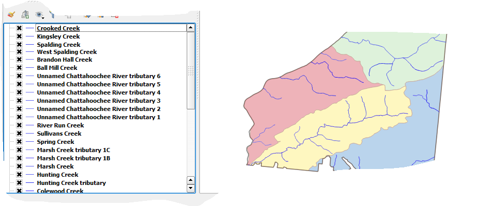
To solve this, I found I could use singleparts to multiparts QGIS tool to make the separate stream segments whole (avoiding using the word join or merge because I didn't want to confuse with these tools as the segments I was putting together were all within the same line vector). The result, however, is that each newly whole stream became a separate line vector shapefile. Now I need to figure out within QGIS (or other tools accessible through QGIS?) how I can "merge" the separate creek line vector shapefiles into one shapefile that I can make appear in layers list in such a way as to name all the creeks separately rather than simply "blue line = creeks"). I'm used to ArcGIS and am learning QGIS bit by bit. I don't know whether I need to figure out how to put in spatial reference such as coordinates (but this being a stream, I would have to figure out how to put coordinates for a stream - headwater, for instance?) or determine if QGIS uses ObjectIDs (no indication thus far.)

Hope this makes sense.

enter image description here

enter image description here

2
  • So I tried the dissolve lines method. It worked except it highlighted a separate issue where it made two extra fields which, because I didn't have any other unique identifiers at that time, I kept as "Name" when I was setting up the process. The two other attributes then appeared as duplicate fields called "name " in the output attribute table. I couldn't figure out how to fix this without also trying to figure out how to edit and populate an attribute table (I need to post a separate ask). But I'm looking for other solutions - direct and "work arounds" to combine separate line vector files
    – user101925
    Commented Jul 17, 2017 at 21:47
  • The other problem was that there were several segmented tributaries to the main river - as in several tributaries, all of which were segmented. So when I "dissolved lines" it combined all the tributaries in one row under the name "chattahoochee river tributary." Open to options including exporting/saving files in different format to access different processing tools. Please help.
    – user101925
    Commented Jul 17, 2017 at 21:48

1 Answer 1

0

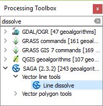
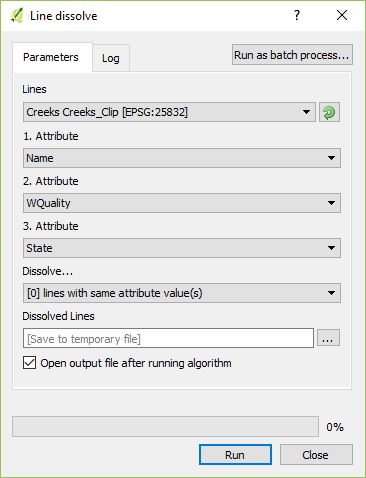
The best thing would be to use 'Line dissolve' from the SAGA-Toolbox in the proccessing window onto your unprocessed data.

enter image description here

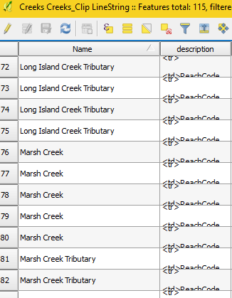
With this you can 'dissolve' Lines with the same attributes into one geometry. Applied on your example this would mean all lines with the attribute "Name" = 'Marsh Creek' could be merged to a multigeometry.

enter image description here

Be cautious! The 'Line dissolve' tool doesn't correct bad drawing quality like disconnected line parts.

The segmentation of those creeks could have other reasons than plain drawing error, like field trips to gather data or crossing administrative borders or changing water quality. Just my thoughts and probably something for another question ;)

2
  • Thanks, helpful in most ways. Wanted to clarify a few points. You mentioned it does not correct for poor drawing quality such as disconnected line parts. If I understand correctly, you mean such cases as where vertices don't overlap and there is measurable space between segments. Will try this.
    – user101925
    Commented Jul 17, 2017 at 18:27
  • 1
    If their attributes fit, they will be dissolved into the same multigeometry but without altering their appearance -> disconnected vertices stay disconnected. P.S.: Sorry if i were unclear - I'm no native english speaker and appreciate any kind correction
    – Nightwatch
    Commented Jul 17, 2017 at 18:49

Your Answer

By clicking “Post Your Answer”, you agree to our terms of service and acknowledge you have read our privacy policy.

Not the answer you're looking for? Browse other questions tagged or ask your own question.