11

A close friend from my company asked me a question about a topographic scaled map (1:25.000):

What was the altitude to a location in km (as you are viewing Earth from space) when he was viewing the map from 1 meter away?

I have been working with scaled maps in the GIS world for a long time but I have never wondered what was my viewing altitude from a topographic map.

If you know any formulae, can you provide an explanation?

2 Answers 2

6

According to THIS source the formula is: map scale in kilometers per centimeter times the map viewing distance in centimeters

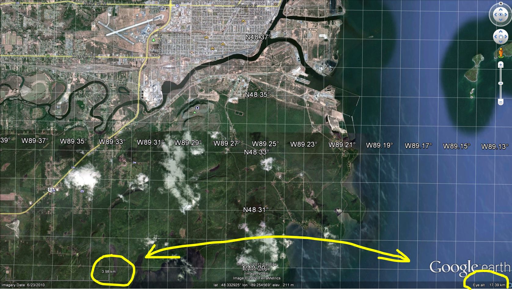
Google Earth does not allow you to see the map scale but is does have a scale bar and also shows the Eye Altitude in the right bottom corner.

enter image description here

5
  • 4
    That source is correct but its use of units is confusing. A scale is unitless. Therefore, you are free to measure your viewing distance in any unit you please. Dividing it by the map scale does the trick (1 meter divided by 1/25000 = 25 km, for example).
    – whuber
    Commented May 4, 2012 at 15:53
  • @whuber have you got any formule for calculating the distance different from these explanations.
    – urcm
    Commented May 4, 2012 at 15:58
  • @Jakub can you pls give me an example about this formule with my variables as map scale = 1:25.000 and viewing distance = 1 meter...
    – urcm
    Commented May 4, 2012 at 16:01
  • 3
    I provided the formula in my comment, @Aragon: divide the viewing distance by the scale. It's that straightforward.
    – whuber
    Commented May 4, 2012 at 18:19
  • 1
    The way that the formula is given, makes it seem unnecessarily complicated. I explain this by saying that the scale works not only in the plane of the map, but also out of the map; So if the sale is 1:25K and you are viewing it from 1 m, your viewing distance is 25 km (1*25000= 25000m =25km) Commented May 5, 2012 at 10:43
3

Scale is uniform in topo maps so it should work in all dimensions, not just in 2. So keeping with the 1:25,000 scale, 1 meter would be 25,000 meters. Your friend was then viewing the map at the equivalent of 25 kilometers.

The only difference would be the terrain height, which could be calculated by adding the elevation of that point to 25 kilometers. So looking at a topo of Mount Everest would give a viewing height of 25 + 8.848 = 33.848 kilometers.

1
  • 2
    The first part is correct but the second paragraph appears to make contradictory assumptions. No view at any finite distance will look like a contour map (as you well know from comparing orthophotos to uncorrected aerial photos).
    – whuber
    Commented May 4, 2012 at 15:52

Your Answer

By clicking “Post Your Answer”, you agree to our terms of service and acknowledge you have read our privacy policy.

Not the answer you're looking for? Browse other questions tagged or ask your own question.