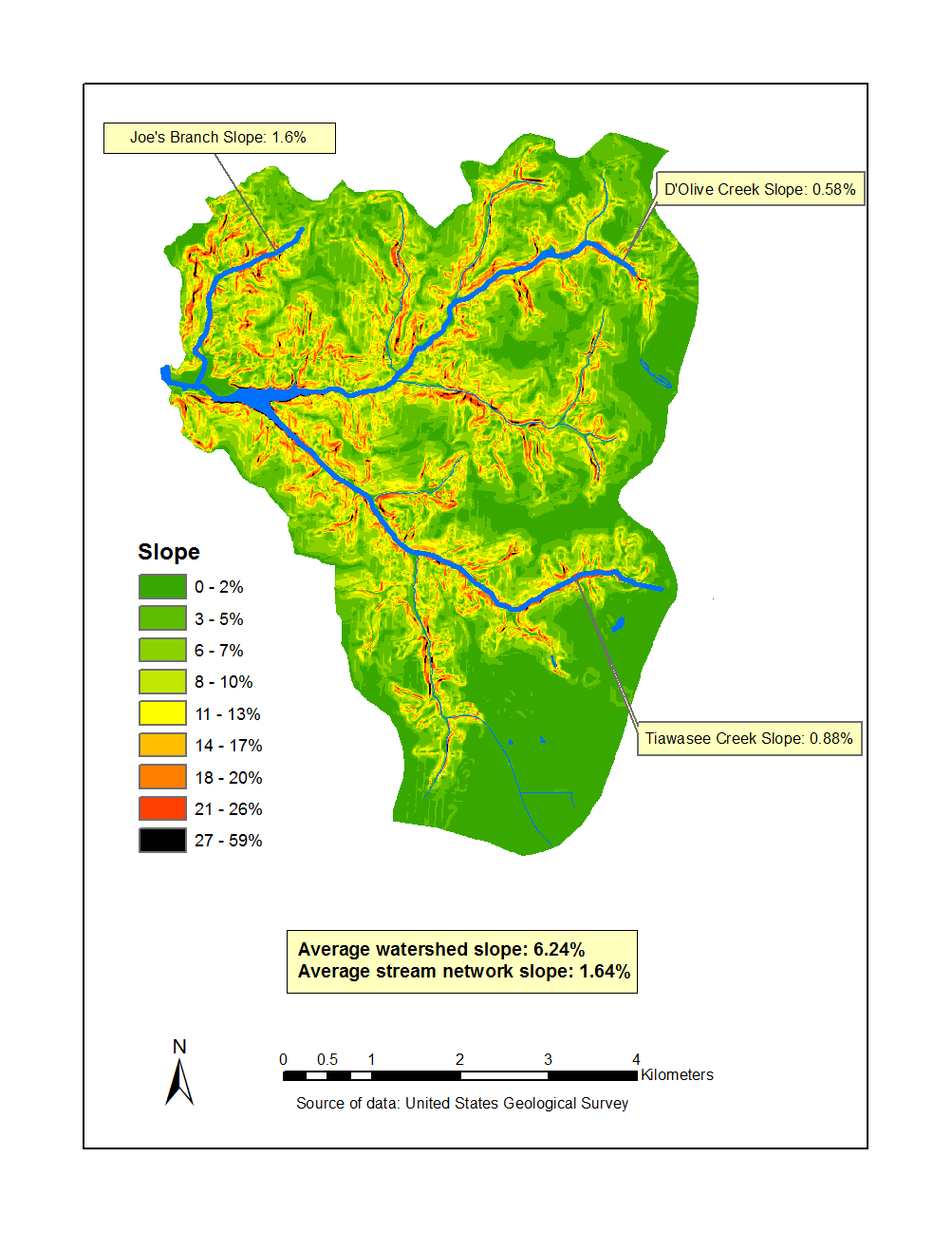
I have created this slope map using a 10m DEM from alabamaview.org and I just noticed it has small striations (zoom to see):
 What could cause this, and is it a big deal, or am I over-analyzing the map?
I have created this slope map using a 10m DEM from alabamaview.org and I just noticed it has small striations (zoom to see):
 What could cause this, and is it a big deal, or am I over-analyzing the map?