1

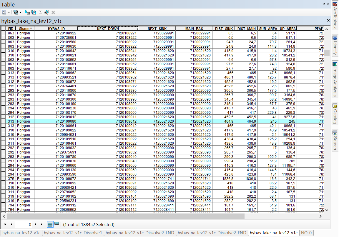
I'm using HydroSHEDS watersheds shapefiles for a proyect. Watershed are delinated applying the rules of Pfafstetter codification.

I need to merge/union the different polygons in a same shapefile. I need to select values for 2 different colums (values are the same, one is the HYBAS_ID and the other is the NEXT_DOWN) in the table of attributes, that way I can contruct the upstream basin. Also I need to keep some attributes and also sum others.

I'm using ArcGis 10.3.

Any idea in how can I do this?

Table of attributes

2
  • 1
    Dissolve on HYBAS_ID and NEXT_DOWN. Then use a spatial join to pull in the attributes (set your merge rules for each field to specify sum or whatever you want)
    – jbalk
    Commented Aug 29, 2017 at 4:48
  • I too am interested in the best way to do this. Merging by NEXT_DOWN can identify numerous sub-watersheds in some cases (e.g., all watersheds surrounding and draining into a large lake). Other suggestions on how to associate hydrobasins sub-watersheds with their larger parent watershed, without jumping all the way up to the highest, most general hydrobasin watershed boundaries? This can be done manually by adding a more general hydrobasins layer and selecting by location, but it seems in the attribute code there must be a way to achieve similar results?
    – Dan
    Commented Feb 24, 2018 at 21:59

0

Your Answer

By clicking “Post Your Answer”, you agree to our terms of service and acknowledge you have read our privacy policy.