2

I wonder if someone can give me a hint on how to interpolate sparse data. I have a 1km by 1km tile located in a dense rain forest area.

Original LiDAR data are 37,395,021 points. I have played with them in several LiDAR processing programs (LAStools, MCC-LIDAR, Fusion, PDAL, to name a few) to get bare earth data.

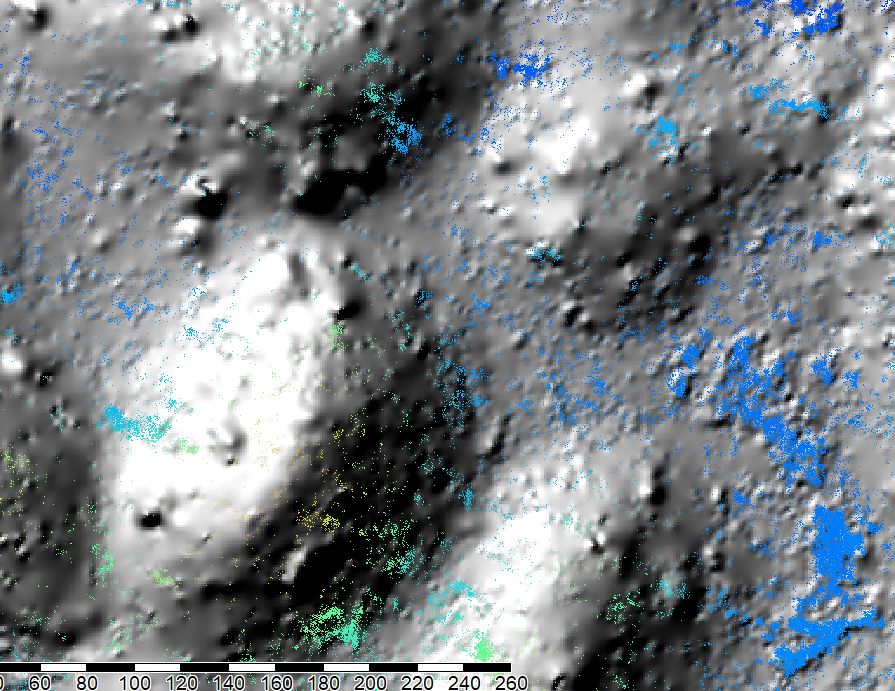
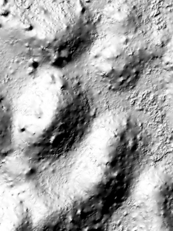
Since the area covered has trees between 20-50m in height I have only 10% of the original data as ground points. For Instance, in one of my experiments I have 3,110,079 ground returns. The original data has a density of almost 27 points per square meter, while the ground data has 4 points per square meter. I have interpolated the data using SAGA Multilevel B-spline interpolation with a cell size of .5, 1 and 2m. I have also tried kriging, IDW, etc, and cannot obtain a smooth surface.

This is an example of the Multilevel B-spline interpolation showing ground points:

enter image description here

This is the same data using kriging:

enter image description here

Any ideas are welcome.

3
  • If you can't obtain a smooth surface, maybe a fraction of filtered points are bushes or small plants
    – aldo_tapia
    Commented Jan 22, 2018 at 15:48
  • That is what I am afraid off... Commented Jan 22, 2018 at 15:49
  • Did you try with ENVI LiDAR? IMO has a great performance filtering trees, bushes, near-to-ground observations and output DEMs are smoothed
    – aldo_tapia
    Commented Jan 22, 2018 at 15:54

2 Answers 2

3

You have quite a bit of residual ground vegetation. I have found that with filters that have adjustable parameters (eg., MCC) often a second pass filter with a change in model parameters can remove much of this ground vegetation. Generally, the first pass has parameters more appropriate for identifying objects such as trees. As such, objects with different topologies are missed. In the second pass, a change in parameters can account for these different object topologies; eg., large patches of contiguous vegetation with low amplitudes (uniform low heights).

After you have acquired a suitable ground classification, if you have access to ArcGIS, I would highly recommend the iterative finite difference spline interpolation which is based on ANUDEN (Hutchinson 1988). This interpolation method is available in the Topo to Raster tool. Because it accounts for representation of ridge structures and can enforce drainage connection, I have found this to produce the most "usable" DEM's from lidar point clouds.

1

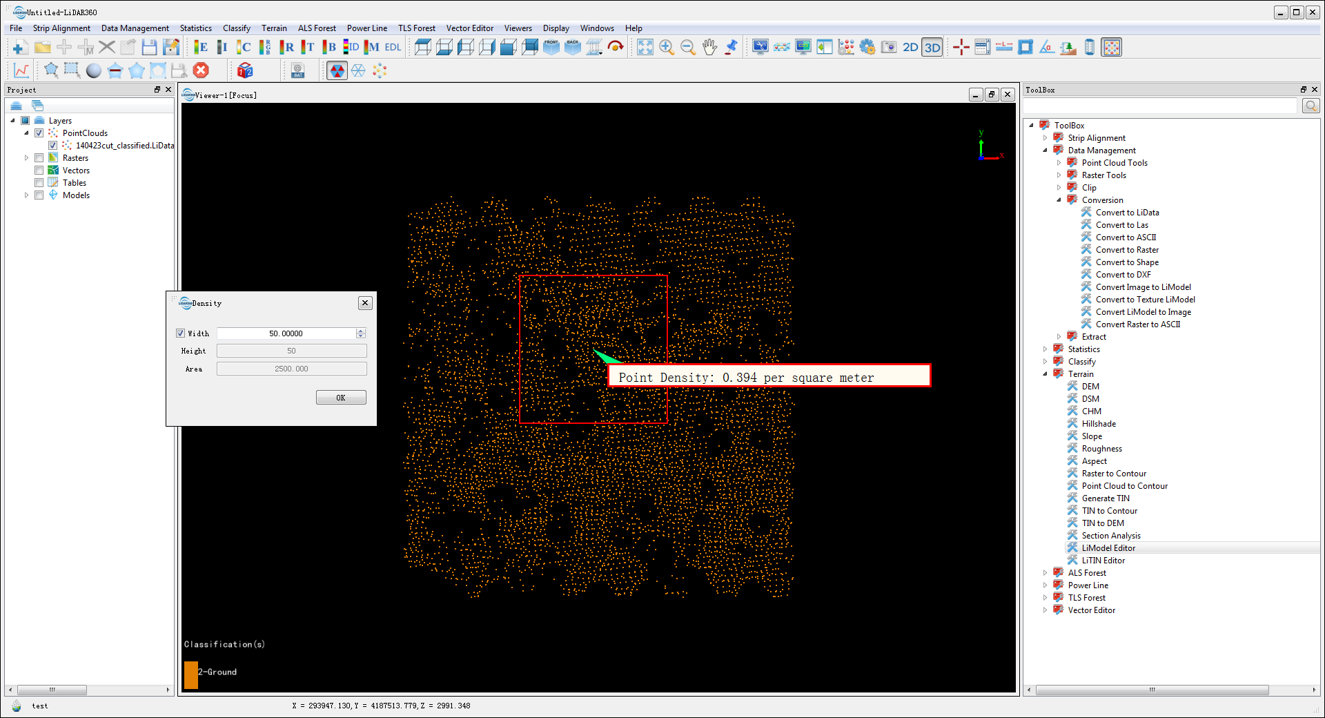
You can try LiDAR360 software. As the picture shown below, the density of ground points is 0.4 per square meter: enter image description here

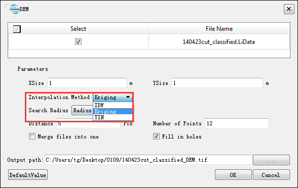
  1. Generate DEM, there are three interpolation methods, IDW, TIN and Kriging. enter image description here
  2. Convert DEM to LiModel for 3D visualization and editing. enter image description here
  3. You can select area of interest using polygon selection, lasso selection, screen selection, or shp selection, which can be edited by various operations such as flatten height, smooth height, repair no data, repair height by variance. The following figure shows the effect before and after the smoothing of the elevation. enter image description here
  4. Convert the edited LiModel to TIFF.

Your Answer

By clicking “Post Your Answer”, you agree to our terms of service and acknowledge you have read our privacy policy.

Not the answer you're looking for? Browse other questions tagged or ask your own question.