7

I have created WMTS using GeoServer and this is tiled service. When i am visualizing this in browser, this is showing me labels and geometry perfectly fine. But when i open this in QGIS using Add WMS/WMTS Tiled Layer, it is blurring/distorting the geometry and labels in QGIS.

How can i fix this problem?

I have checked layer in QGIS2 and QGIS3, there wasn't any difference.

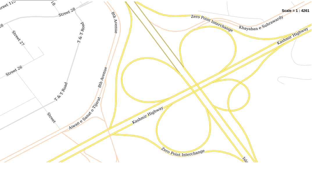
This is WMTS Loaded in Browser

enter image description here

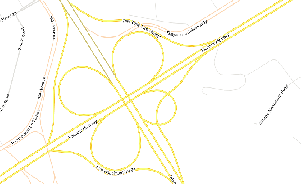
This is QGIS WMTS loaded

enter image description here

3 Answers 3

13

By the looks of it you render the QGIS WMTS in a different projection than the original WMTS. This can be seen by the angle of intersection of the highways. In QGIS this seem to be a perfect 90 degree angle, in the browser it is not. The reprojecting is done locally in QGIS, not at the server side. Therefore the original image gets distorted resulting in the blurred/distorted view.

Try changing the projection in QGIS to the same as the original WMTS is in, that should resolve the problem.

2
  • I have the same projection set in QGIS, as that of my layer. Commented Apr 30, 2018 at 10:17
  • In that case try the answer provided by @buddiebubba
    – LMB
    Commented Apr 30, 2018 at 10:22
11

The zoomscales in QGIS probably differ from the configured grid set in GeoServer. This causes resampling of the images in QGIS resulting in less sharp images and less performance.

See GeoServer documentation.

You can change the zoomscales in QGIS via:

  • Settings
  • Options
  • Map Tools
  • Predefined zoomscales

Different sets I use are: (Copy paste to XML, then import XML in QGIS config.)

Google maps:

<qgsScales version="1.0">
    <scale value="1:591657551"/>
    <scale value="1:295828775"/>
    <scale value="1:147914388"/>
    <scale value="1:73957194"/>
    <scale value="1:36978597"/>
    <scale value="1:18489298"/>
    <scale value="1:9244649"/>
    <scale value="1:4622325"/>
    <scale value="1:2311162"/>
    <scale value="1:1155581"/>
    <scale value="1:577791"/>
    <scale value="1:288895"/>
    <scale value="1:144448"/>
    <scale value="1:72224"/>
    <scale value="1:36112"/>
    <scale value="1:18056"/>
    <scale value="1:9028"/>
    <scale value="1:4514"/>
    <scale value="1:2257"/>
    <scale value="1:1128"/>
</qgsScales>

PDOK:

<qgsScales version="1.0">
    <scale value="1:12288000"/>
    <scale value="1:6144000"/>
    <scale value="1:3072000"/>
    <scale value="1:1536000"/>
    <scale value="1:768000"/>
    <scale value="1:384000"/>
    <scale value="1:192000"/>
    <scale value="1:96000"/>
    <scale value="1:48000"/>
    <scale value="1:24000"/>
    <scale value="1:12000"/>
    <scale value="1:6000"/>
    <scale value="1:3000"/>
    <scale value="1:1500"/>
    <scale value="1:750"/>
    <scale value="1:375"/>
    <scale value="1:188"/>
    <scale value="1:94"/>
</qgsScales>

ESRI:

<qgsScales version="1.0">
    <scale value="591657528"/>
    <scale value="295828764"/>
    <scale value="147914382"/>
    <scale value="73957191"/>
    <scale value="36978595"/>
    <scale value="18489298"/>
    <scale value="9244649"/>
    <scale value="4622324"/>
    <scale value="2311162"/>
    <scale value="1155581"/>
    <scale value="577791"/>
    <scale value="288895"/>
    <scale value="144448"/>
    <scale value="72224"/>
    <scale value="36112"/>
    <scale value="18056"/>
    <scale value="9028"/>
    <scale value="4514"/>
    <scale value="2257"/>
    <scale value="1128"/>
    <scale value="564"/>
    <scale value="282"/>
    <scale value="141"/>
    <scale value="71"/>
</qgsScales>
3
  • 1
    This set of zoom presets might be useful. alephnull.net/software/gis/tile_writer/scales.xml You can add them using Settings → Options → Map Tools → Predefined Scales → Import from file (folder icon) In the images shown in the question there definitely is reprojection going on though. Commented Apr 30, 2018 at 10:29
  • Thanks @AlexHajnal, this actually helped me to setup and make representation better! Commented Apr 30, 2018 at 10:52
  • But when i am changing canvas to on the fly projection. It is distorted again. Commented May 1, 2018 at 17:34
2

Try using the TileMapScaleLevels plugin, which accounts for the different sets of scales needed by the usual EPSG3857 projection (web mercator) and typical zoom levels: https://plugins.qgis.org/plugins/TileMapScaleLevels/

Besides, you can enable and disable as needed, without changing your usual QGIS scales.

Your Answer

By clicking “Post Your Answer”, you agree to our terms of service and acknowledge you have read our privacy policy.

Not the answer you're looking for? Browse other questions tagged or ask your own question.