J.R's answer made the difference and I am now using the Advanced Digitizing Panel as I wanted. I am adding some more information that I learned along the way.
The Advanced Digitizing Panel only works when the Coordinate Reference System (CRS) being used by the project is a PROJECTED rather than a GEOGRAPHIC CRS. The reason for this is that advanced digitizing uses linear units of measure, such as feet or meters, which is more compatible with a projected, than with a geographic, CRS.
A geographic CRS utilizes angles (degrees latitude and longitude) to represent points on a surface, while a projected CRS utilizes linear measures (feet to the North or to the East of a reference point). The underlying math of a geographic CRS is essentially spherical geometry, while the projected CRS utilizes planar geometry.
Advanced digitization uses linear measures of distance and thus translates easily into the coordinates of a planar projection, whereas using linear measurements on a spherical surface is much more computationally difficult (trig!) and less intuitive. Even the angles used in advanced digitizing are planar, and are incompatible with angles on the surface of a sphere. For instance, the interior angles of a planar triangle sum to 180 degrees - but this is not true for a triangle on a spherical surface.
Because it is simpler, more intuitive, and probably actually what is wanted, advanced digitization is confined to projected (planar) CRSs and is not supported for geometric (spherical) CRSs.
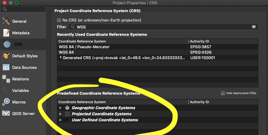
How do you configure QGIS for a projected CRS, rather than a geometric CRS? The Project -> Project Properties -> CRS dialog is used to select a CRS for the project. The default QGIS CRS for a new project seems to be "WGS 84" which is a geometric CRS and advanced digitization will not work with it. The "Coordinate reference systems of the world" table in this dialog is a catalog of CRS's, many of which are projected rather than geometric. If you know which is which, you can select an appropriate projected CRS for your project. I do not know how to distinguish them.

