2

I understand that this question has been asked before in one form or another, but unfortunately those answers haven't been able to solve my issue.

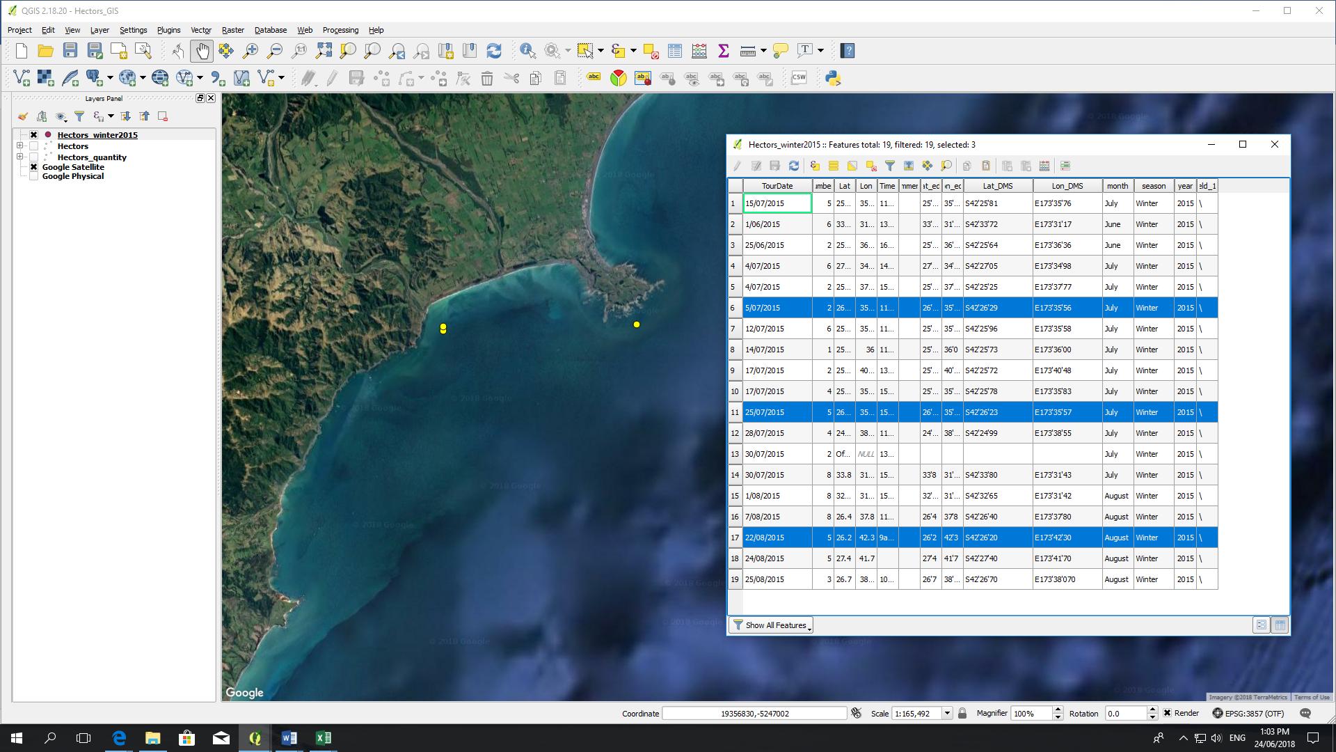
I've imported a .csv file into QGIS and all the data is visible on the attribute table - however only 3 out of the 13 points are shown on the map. I've selected those three on the table for the image and can't work out why the other points aren't shown.

Picture to show missing data points

The points on the map are in the correct place so I don't think it's an issue with the projection.

I've also tried copying the data into a google spreadsheet then re-downloading it as a .csv (as one previous question/answer had suggested) but had no luck.

Any suggestions are welcomed!

3
  • what column are you using to generate the geometries? it seems the Lat/Lon columns are only using the degree minutes.
    – geozelot
    Commented Jun 24, 2018 at 1:25
  • using the Lat_DMS and Lon_DMS and selected them as DMS coordinates when importing the file into QGIS
    – Hectors
    Commented Jun 24, 2018 at 1:32
  • 3
    Those coordinates are NOT in degrees, minutes, and seconds, they're in degrees, decimal minutes (DD MM.mm). It's impossible for a coordinate to have a seconds value greater than 60, but many of yours do. That means they are not in DDMMSS, and they are NOT in the right place, no matter what other problems you may think you have.
    – Dan C
    Commented Jun 24, 2018 at 2:26

0

Your Answer

By clicking “Post Your Answer”, you agree to our terms of service and acknowledge you have read our privacy policy.

Browse other questions tagged or ask your own question.