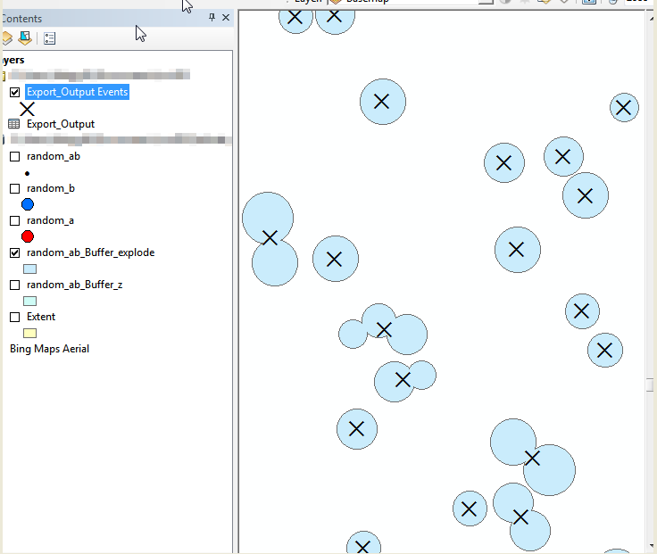
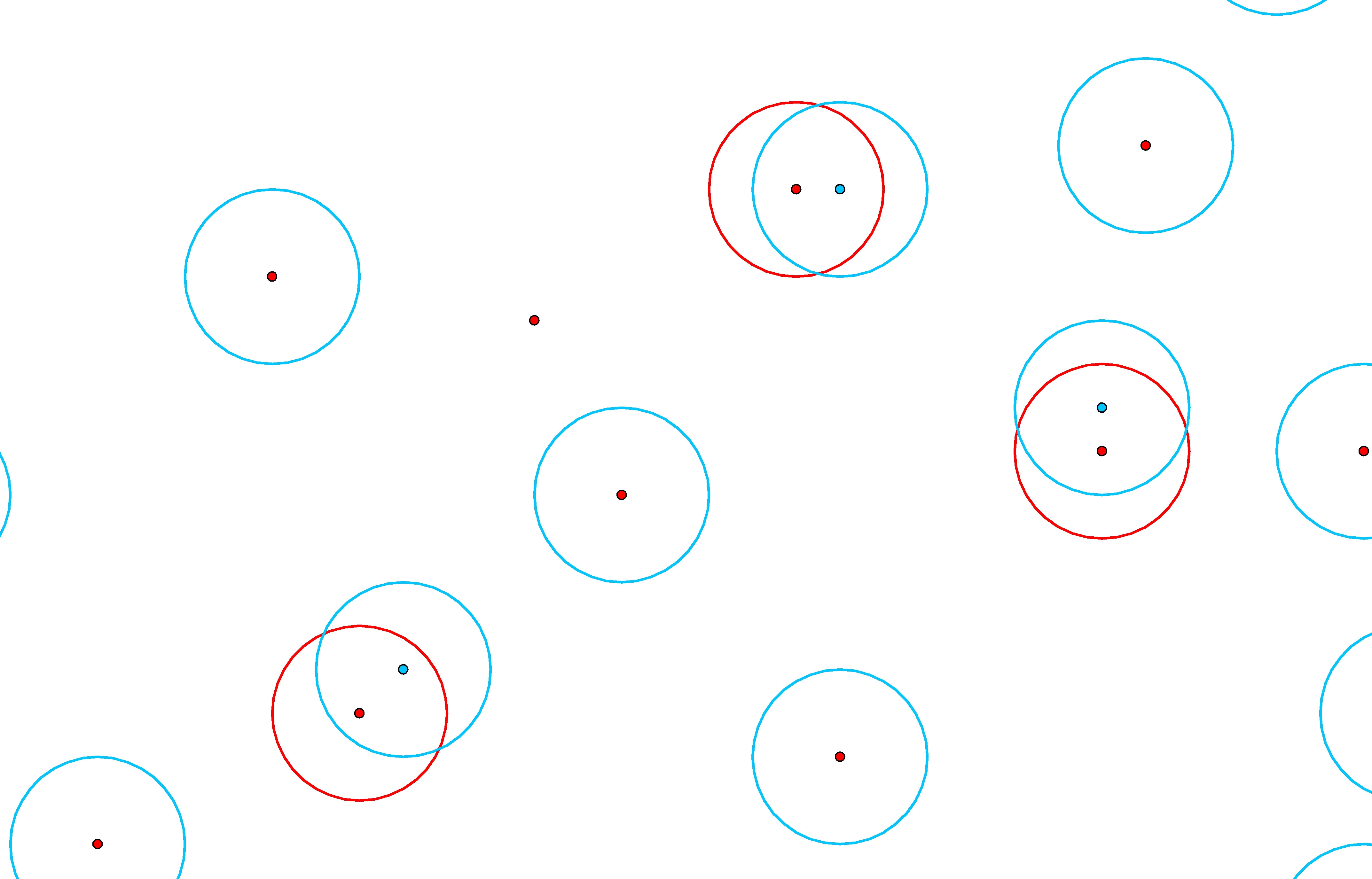
I was going to write my solution on the premise that you only had two layers, but I realized that a single layer solution would be both easier and more extensible. Please have a read through the following points, and let me know if you need clarification on any points.
1. Merge Data Into One Class / Shapefile
Just execute the Merge tool on each existing class / shapefile until you only have one to work with.
2. Calculate Z Geometry
If the geometry is Z-Enabled, you need to calculate the Z value into the attribute table in order to apply it to the buffer command.
Note: You will need to reference this process in a later step as well.
2.1. Add a Field
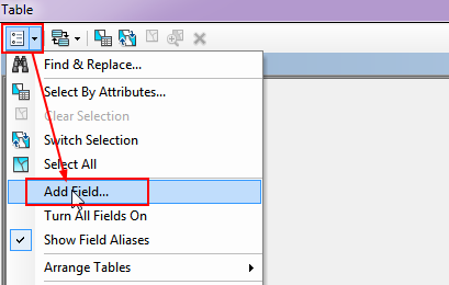
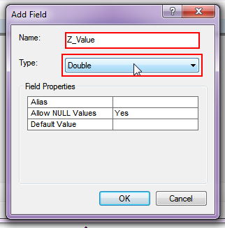
2.2. Set Field Type
2.3. Calculate Geometry
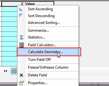
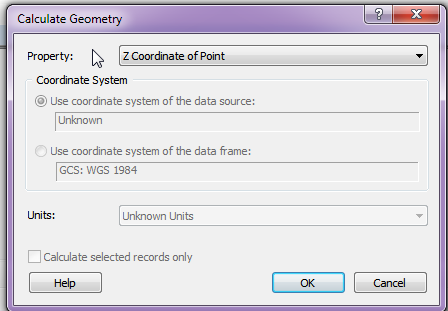
3. Geoprocessing
3.1. Buffer your points using the Z_Value field as a reference. Make sure to check the appropriate dissolve function.
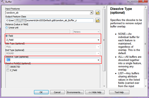
3.2. Execute the Multipart to Singlepart tool to explode the data.
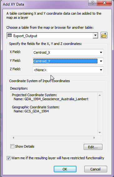
3.3. With the exploded data, add two new fields called 'Centroid_X' and 'Centroid_Y'.
3.4. Use the process defined in step 2 to extract the X and Y coordinates to the Centroid columns you just created.
3.5. Export the Attribute table to a DBF file. (Be sure to set the file type to DBF.)
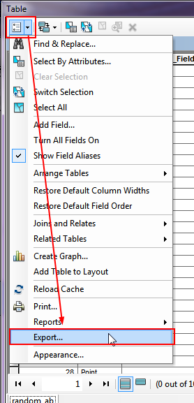
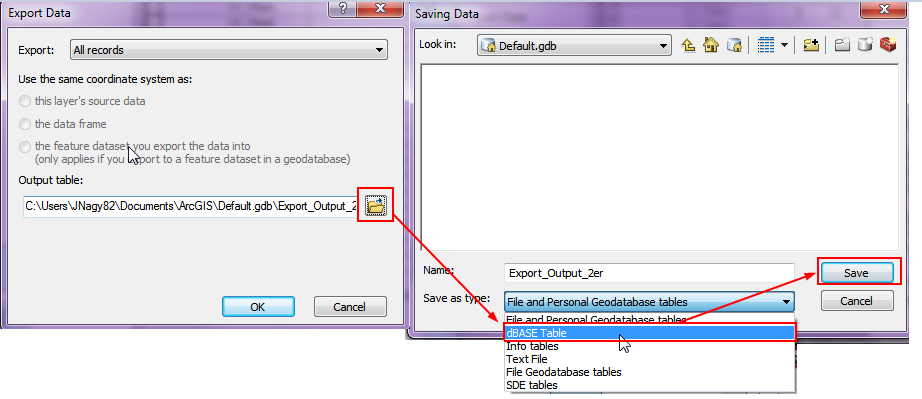
3.6. Import the DBF file into the map, and add the X, Y data to the map frame.
4. Done
