3

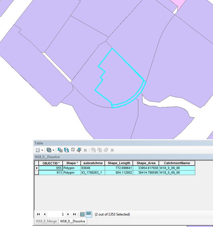
I have a feature class with parcel information; some of the parcels have roads included while others do not. When a parcel has a road included there is always a matching parcel without the road included. But there isn't always a parcel with the road included. In the image below you can see there are two parcels sitting on top of one another; one includes the road while the other does not.

image of parcels that needd to be merged

From my research I know dissolve should be the way to go but the problem is there are not matching fields. I have tried to straight dissolve (without the option dissolve based on field) but, since they have matching boarders it dissolves into the road blocks and the parcels are no longer distinguishable. There is no common field to dissolve on and I want to be able to automate this since I need to be able to do it for a large area. Also, when there is the situation of two parcels on top of one another I would like to keep the 'subcatchme' values with letters proceeding it as seen in the record with 'subcatchme' = ICI_1788263_1.

It is important to note there are often parcels that do not have overlapping attributes, and I don't want to loose those records. Also I must keep the field 'CatchmentName'.

I am working in ArcMap 10.4 with the advanced license. I can work in arcpy though I am not the most experienced.

4
  • 1
    You should be looking at Union. You can run 1 feature class through Union (it doesn't have to be multiple feature classes).
    – jbalk
    Commented Nov 21, 2018 at 19:18
  • @jbalk I looked into Union but it breaks everything apart then I still have the same issue I had before. Nothing to relate the newly created piece of road to its matching parcel.
    – TarenKoeth
    Commented Nov 21, 2018 at 19:28
  • indeed. this is a complex problem that is not going to be accomplished with any one tool. union splits everything so you can identify overlaps with something like Identify Duplicates. You then somehow need to split out the roads from the parcels and then maybe spatial join on the parcels to match roads to parcels.
    – jbalk
    Commented Nov 21, 2018 at 20:38
  • The (3rd party) 'Find Overlapping Features' tool may be useful here. (See: arcgis.com/home/item.html?id=968e6a55a11640d2b9cfa211104d3811 ). You could then pull these out into their own layaer, dissolve them separately from the other features, and then replace the old overlapping features with the new dissolved ones. Commented Nov 21, 2018 at 22:19

3 Answers 3

1

Workflow below will only work on topologically correct polygons(!)

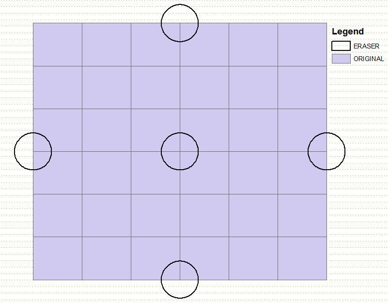
To create something similar I erased 12 polygons and merged them to 36 original: enter image description here

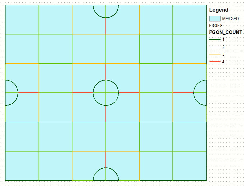
  • Used feature to line on MERGED to create EDGES
  • created and populated NAME field in EDGES
  • spatial join (share segment with) of resulting EDGES(1:M) to MERGE
  • Picture below shows with how many MERGE polygons share the EDGE: enter image description here

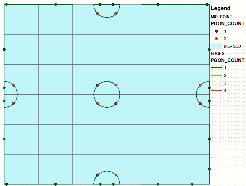
The ones with PGON_COUNT = 1 are of interest. So I derived their mid points and counted number of polygons they intersect using spatial join:

enter image description here

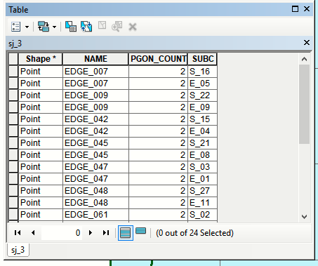
The ones with PGON_COUNT = 2 are of interest:

enter image description here

From that table values stored in NAME can be easily transferred to MERGE polygons to be used for dissolve.

0

This is a little vague, and I've not tried it myself. But may be worth a shot...

Create a copy of your feature class (say, 'fcCopy'). Then run an intersect on the 'fc' original feature class, and the 'fcCopy' feature class.

Now you can select overlapping polygons from the intersection where 'OBJECTID_fc <> OBJECTID_fcCopy'.

Export these overlapping polygons out to a new feature class.

Dissolve the new feature class.

Replace the overlapping features in the original feature class with the dissolved ones if desired.

(This idea comes from one of the answers at: https://community.esri.com/thread/7714 )

It may require some further complication for overlapping features that are adjacent to other overlapping features, to avoid dissolving with them. In this case, you may need to do the export/dissolve/replace separately for each pair of overlapping features.

0

I have tried both suggestions by Son of a Beach & FelixIP but I was unable to recreate them. I have come up with a solution that is not perfect but works for now.

I broke the feature class into two separate files; with roads included and without (Based on naming of 'subcatchme' field). I then use the 'Update' Tool, without borders (with borders it makes a lot of little slivers). I used without roads as the original feature class and updated it with the feature class including roads. It worked pretty well but as FelixIP stated this method would require topologically correct polygons. Unfortunately, my parcels are not. So if the update parcel falls a little into a parcel without an additional road it will take over the one without a road.

Your Answer

By clicking “Post Your Answer”, you agree to our terms of service and acknowledge you have read our privacy policy.

Not the answer you're looking for? Browse other questions tagged or ask your own question.