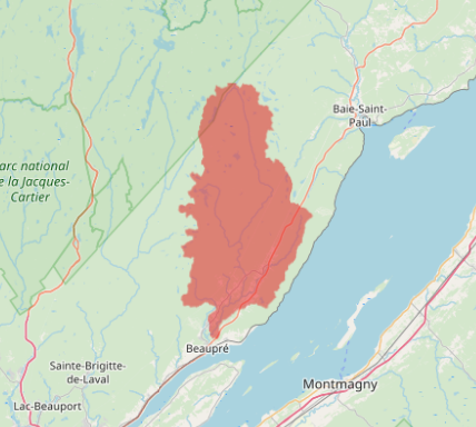
Using a DEM, I want to define catchment boundaries for a given location on a river. Basically, what area drains into this point. In ArcMap, I can do that with flowacc and other tools; but I'd like to do that in R. I know how to import a DEM raster in R but that's about it.
2 Answers
To complete @Marco's answer, watershed can be done in GRASS through RQGIS3 or done in RSAGA. Of course, you need QGIS, GRASS and SAGA installed on your computer.
Here is an example. The DEM comes from : http://ftp.geogratis.gc.ca/pub/nrcan_rncan/elevation/cdem_mnec/021/
GRASS (through RQGIS3)
library(gdalUtils)
library(RQGIS3)
library(here)
set_env("C:/OSGeo4W64")
qgis_session_info()

gdal_translate(here("data", "cdem_dem_021M.tif"),
               here("temp_files", "dem_temp.tif"),
               projwin = c(-71.2, 47.5, -70.5, 47))
#get_usage(alg = "grass7:r.watershed")
run_qgis(alg = "grass7:r.watershed",
         elevation = here("temp_files", "dem_temp.tif"),
         threshold = 5000,
         drainage = here("temp_files/drain.tif"))
#get_usage(alg = "grass7:r.water.outlet")
bassin_grass <- run_qgis(alg = "grass7:r.water.outlet",
                         input = here("temp_files/drain.tif"),
                         output = here("temp_files/bassin_grass.tif"),
                         coordinates="-70.8837037458,47.0692354224",
                         load_output = TRUE)
SAGA (through RSAGA)
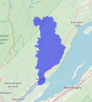
If you're not satisfied with GRASS, do:
library(RSAGA)
rsaga.fill.sinks(in.dem = here("temp_files", "dem_temp.tif"),
                 out.dem = here("temp_files", "no.sink.sgrd"),
                 out.wshed = here("temp_files", "bassin_saga.sgrd"),
                 method = "wang.liu.2006")
bassin_saga <- raster(here("temp_files", "bassin_saga.sdat"))
bassin_saga[bassin_saga!=1307] <- NA
which produces:


