2

Background:

I have both QGIS 3.4.1 and ArcGIS Desktop 10.6.1 installed on the same laptop, Windows 10.

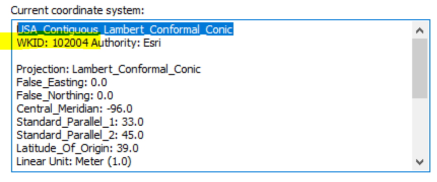
I have a polygon shapefile that is projected to Lambert Conformal Conic. Arc states that the shapefile's EPSG value is 102004. Here's a screenshot from the Arc Layer Properties:

enter image description here

spatialreference.org agrees with Arc; 102004 is Lambert Conformal Conic:

enter image description here

So far, so good!

Problem:

QGIS states that this layer's EPSG value is different: 100027. Here's a QGIS screenshot:

enter image description here

But wait, there's more! spatialreference.org does not have an entry for 100027. Here's a screenshot:

enter image description here

Question:

Why doesn't the QGIS EPSG value match Arc and spatialreference.org? What does the 100027 value represent?

3
  • 102004 isn't an EPSG code, notice it is ESRI:102004 not EPSG:102004 in spatialreference.org and WKID:102004 Authority:Esri in the layer properties.
    – user2856
    Commented Nov 25, 2018 at 21:12
  • QGIS does not state that it is an EPSG code. QGIS considers that CRS as somethign that does not belong to the EPSG database and gives it some number that is not reserved for EPSG codes. You can see that all the parameters are the same which means that this CRS behaves in the same way even it has a different code in QGIS.
    – user30184
    Commented Nov 25, 2018 at 21:14
  • 1
    Also note that the proj definition string from ESRI:102004 from spatialreference.org is exactly the same as what QGIS shows you - +proj=lcc +lat_1=33 +lat_2=45 +lat_0=39 +lon_0=-96 +x_0=0 +y_0=0 +datum=NAD83 +units=m +no_defs so although QGIS doesn't know the name of this custom ESRI (non-EPSG) projection, functionally there is zero difference between ArcGIS and QGIS when you use this projection.
    – user2856
    Commented Nov 25, 2018 at 23:02

1 Answer 1

4

When you add a new custom projection to QGIS, it allocates a unique code to it and stores it in a local sqlite database (srs.db)

The first one you add is numbered 100000, the second is 100001... and numbers are allocated sequentially each time you do this. As @user30184 says, this is to prevent duplicates.

Your 100027 doesn't correspond to the corresponding ArcGIS/spatialreference.org codes. It means that this is the 28th custom projection you've added (based on the uniqueness of the proj4 string for the projection)

The projection is shown as 'USER:100027', rather than 'ESRI:100027' or 'EPSG:100027', which suggests that it's not equivalent.

Your Answer

By clicking “Post Your Answer”, you agree to our terms of service and acknowledge you have read our privacy policy.

Not the answer you're looking for? Browse other questions tagged or ask your own question.