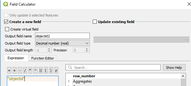
I have a problem that's stumped me. I'm merging flood hazard layers from FEMA. For most states, the objectid is a real number. California (we're always the weird ones) has an objectid that's 'integer64'. I don't know enough about objectids to know which one is correct or if there's a correct option. Merging the layers into a single layer runs into problems with the difference in object ids. Can anyone suggest a solution to this problem? Is there way to convert one or the other objectid fields to match or a setting to select to enable the different types to work together?
I'm using QGIS. I pulled the data from FEMA's Esri Geodatabase. I then clip these layers to my study area and save 'em as shapefiles. I'm working with those, trying to merge them into a single layer

