I have a question regarding the two QGIS Versions 2 and 3. When I load exactly the same raster file into QGIS 2 and QGIS 3 I get different min/max values, how is this possible? I have used the same coordination system.
1 Answer
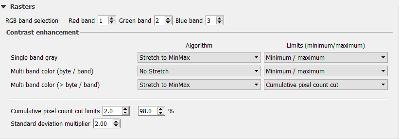
Maybe you have different rendering settings in your both QGIS 2 and 3. Please check the setting from Settings -> Options -> Rendering Settings, especially the Cumulative pixel count cut limits:
Here is my settings in QGIS 3 (the default):
and in QGIS 2 (But here I adjusted for my purpose):
So maybe the settings are different in your case.
-
Thanks a lot for your help! I changed the settings and now the values are the same.– KarolineCommented Oct 24, 2018 at 9:12


