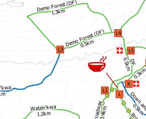
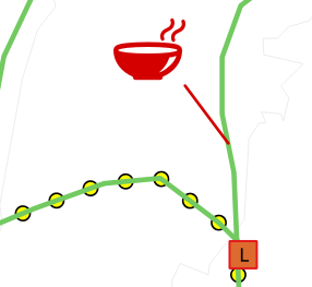
I have a point layer in which some symbols are displayed offset from the feature's true location by a given number of millimetres. As the map's zoom changes the offset symbol's geographic location changes to maintain the millimetre display distance.
I'd like to implement this approach to connect symbols to their features using lines, but to do this I need to know the geographic location of the offset symbol. To do this I need to know the geographic distance of the millimetre offset at the current zoom level and add that to the feature's coordinate.
QGIS obviously knows the scale and crs so in theory it has all the information required, however I'm not sure if a suitable function exists. If one does exist, what is it, and if one does not exist, how would I create one?
Edit to clarify: any solution that assigns fixed geographic locations to labels is inadequate. Offsetting a label using a display distance (mm) ensures the offset remains the same across different scales - this is not true of geographical offsets, which can disappear off-screen or cluster together when zooming in or out. I need an approach that calculates a geographic location based on a mm offset at any scale.


