1

I am working on a project where I need the z value (elevation) of a set of data points.

Is there a way to assign elevation data to a KML in Google Earth without doing it manually for each point?

I have tried using TCX converter and http://www.nearby.org.uk/elevation-kml.php with no luck.

2
  • This might work better for you gpsvisualizer.com/elevation
    – Mapperz
    Commented May 10, 2019 at 0:18
  • How big is your KML file, how many points, and more importantly, how is it being generated? You most likely will want to add the elevations to the points when the KML is generated, likely with some flavor of GIS software. Once the file is loaded in Earth, there's no way to modify it other than editing the points one by one. Also, you'll probably need your own elevation dataset, since Earth will let you visualize its elevation/terrain data just fine, but the terms of service don't allow bulk extraction of data. Commented May 10, 2019 at 17:09

1 Answer 1

1

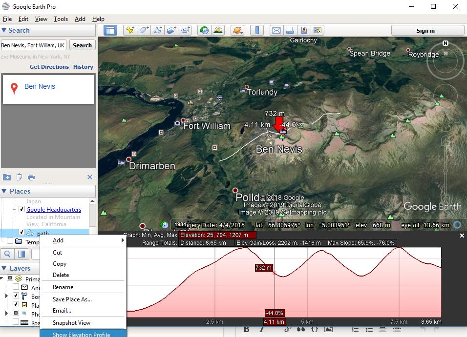
If you have points that can be add to Google Earth Pro and create a path across them you can use the elevation profile along a path.

This image gives you an example:

enter image description here

There you can interactively scroll along the path.

Save this path out and use gpsvisualiser to get elevations.

Your Answer

By clicking “Post Your Answer”, you agree to our terms of service and acknowledge you have read our privacy policy.

Not the answer you're looking for? Browse other questions tagged or ask your own question.