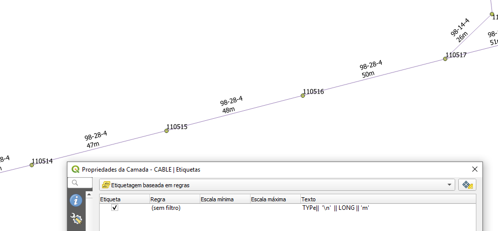
I was able to see the types of cables ("* TYPE " in my data table) entered manually and the length of these cables (automatically calculated using the " Slength *" function with the name LONG in the field calculator). this whole info on the same label
("*TYPE||'\n'||LONG||'m'*").
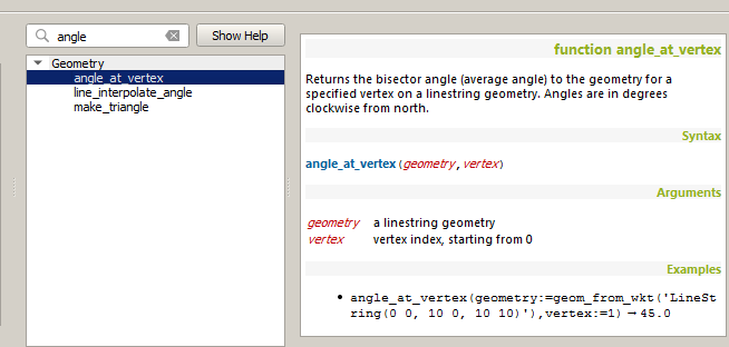
It is now impossible to make visible the orientation of the cables (Shape of line type) in gradians (between 0 and 400), with the origin reference in the Eastern direction.


