1

I am using QGIS 3.6 and trying to calculate coordinates (lat&long) from a point given the distance. I have the lat&long for reference point and have the distance from the reference point.

Table 1

Points A, B, and C are reference locations of a road

Table 2

X, Y, and Z are building within a distance from A toward point B How can I get the lat and long for X, Y, Z?

3
  • Don't you need a direction as well? Commented Jun 25, 2019 at 21:30
  • Can I get the direction from point A to B? Cause these buildings are on A to B line Commented Jun 25, 2019 at 21:45
  • Oh, so the buildings are on the line that starts at A, goes to B, then C? Commented Jun 25, 2019 at 22:12

1 Answer 1

1
  1. Use the points A, B and C to create a line. There are many ways to do this, including:

    • use the points to path tool, or
    • use the geometry by expression tool, or
    • create a line with three vertices, and edit the vertex coordinates using the vertex editor
  2. Use the interpolate point on line tool to create a point at each specified distance. To create multiple points, there are two options. Choose the one that seems most convenient for your dataset.

    • Method one: Run the tool once for each point. This method creates a separate layer for each point. You can merge them into a single layer using the merge vector layers tool.
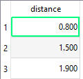
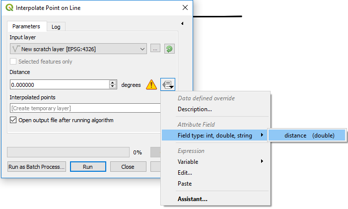
    • Method two: Make a duplicate line for every point you want to create (select the line, copy and paste). Add an attribute field called distance. Enter the point distances in this field.

      enter image description here

    Use the distance field for the distance value.

    enter image description here

  3. Get the lat/long of those points by

    • clicking on each point with the Identify tool, or
    • use the add geometry attributes tool to add lat/long to the attribute table
3
  • You can also use interpolate point on line for step 2
    – strythe
    Commented Jun 25, 2019 at 23:52
  • 1
    @strythe, thank you for the suggestion. I thought there was a tool that did the same as points along geometry but allowed a data-defined override for the distance value.
    – csk
    Commented Jun 27, 2019 at 17:04
  • I was hoping there'd be a tool for this too, one which takes a field of distances and a line geometry.I had to write a script to interpolate multiple points without having to duplicate the line.
    – strythe
    Commented Jun 28, 2019 at 0:11

Your Answer

By clicking “Post Your Answer”, you agree to our terms of service and acknowledge you have read our privacy policy.

Not the answer you're looking for? Browse other questions tagged or ask your own question.