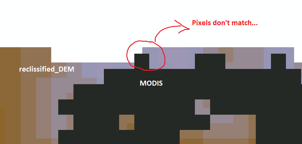
I am using Arcgis 10.1. I have a MODIS raster from the NSIDC website with a pixel resolution of 500 m and an attribute table with the fields 'VALUE' (as the code of snow, clouds, etc.) and 'COUNT' (as the number of pixel in each class (or in each 'VALUE'). I also have a DEM from USGS that I have reprojected to match the Spatial Reference and the pixel resolution of the MODIS (thus increasing the pixel of each cells from the original 83 up to 500 m size). What I would like to do is to have a table (or whatever) showing the area of the snow class for each 200 m elevation ranges (the hypsographic curve of the snow cover). I have reclassified the 500 m resolution DEM as to have 200 m elevation ranges, and now I have a new attribute table showing the 'VALUE' (the different elevation ranges) and their respective pixel 'COUNT'. I've been trying using the Zonal Histogram tool, putting as the input zone my MODIS and as the input value my DEM. The result seemed fine but I noticed that summing the number of pixels of each elevation range within the same class(for instance 'snow' that is the one I need) the final number of pixel is different than the one in the MODIS attribute Table (sometimes a lot different!). No clue why, guess it might be due to spatial difference amongst the two rasters due to the transformation I've made, even though the two rasters were both clipped using the same mask... Here are examples of 2 original Attribute Tables that I have (200 is snow, other numbers are other classes):
    MODIS                 reclissified_DEM
VALUE  COUNT                VALUE  COUNT
 25    240787                   0      2
100       169                 200 188277
...       ...                 ...    ...
200     32265                6600      3
Moreover, I also noticed zooming to pixel extent that the pixels of the two rasters do not match, and I think this leads ArcGIS not working as I'd like. Is there a way to match them as to loose the fewer information as possible? Or, is there an easier way to do all this job?
See the below image to understand what I mean:
 Hope You could help me.
