2

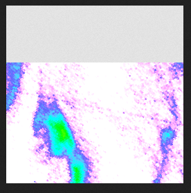
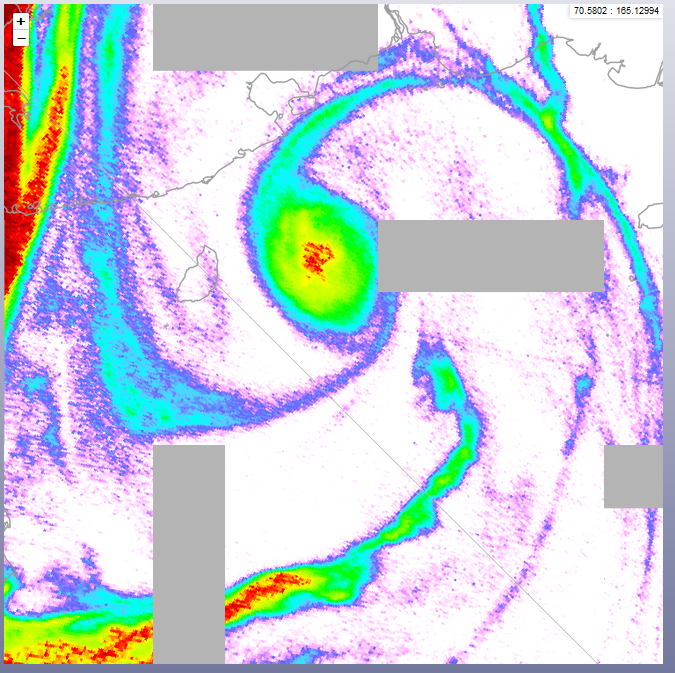
I have created a series of GeoTiff files containing global satellite raster data in EPSG 4326 format. I serve them in GeoServer (v2.15.2) and ask for the data through WMS requests from Leaflet maps in 3 different projections: EPSG 3857 (Web Mercator), EPSG 3413 (Arctic Polar Stereographic) and EPSG 3031 (Antarctic Polar Stereographic). The problem is that the Arctic map often shows artifacts in the form of rectangular areas of missing data (see image). This happens in particular when I zoom in. In the other 2 projections the data is fine. I also include an image of a single tile, showing a missing section. The missing section is always at the edge of a tile. never in the middle.

The closest hint to a solution I found here: Artifacts in NetCDFs served to Leaflet from Geoserver over WMS when zooming

But in my case it does not seem to be related to an x=0 phenomenon. Furthermore, that post never got a final solution.

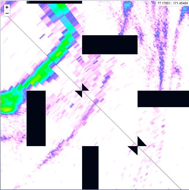
enter image description here enter image description here

Here is an image when unticking "Enabled advanced map projections" in the Geoserver WMS settings. It shows that the tiles with artefacts touch the antimeridian with one corner and even introduces additional, triangular artefacts.

enter image description here

9
  • What requests does Leaflet make. Does it make any requests that cover the extent of the missing data?
    – nmtoken
    Commented Sep 26, 2019 at 18:55
  • If you make epsg::3413 the projection in QGIS and use the service there do you still have the artefacts?
    – nmtoken
    Commented Sep 27, 2019 at 2:23
  • Try to debug whether the issue is actually to do with the way your client makes it's tiling requests, rather than a geoserver issue for serving the data, or even a data issue
    – nmtoken
    Commented Sep 27, 2019 at 2:24
  • Thank you for the suggestions, nmtoken. Here is example WMS request for a single tile, as triggered by Leaflet: mygeoserver/geoserver/SACS/… Entering this request directly in Firefox gives me a single tile, showing the artefact.
    – Jvg
    Commented Sep 27, 2019 at 11:20
  • Studying the map a bit more, I noticed that all tiles showing artefacts touch the antimeridian with one of their corner (-180/180 degrees). This becomes even more clear when unticking "Enable advanced projection handling" in the GeoServer WMS settings. Then sometimes an additional, triangular artefact appears, at the location where the tile touches the antimeridian. See the newly added image to the post.
    – Jvg
    Commented Sep 27, 2019 at 11:20

1 Answer 1

2

Advanced projection handling is supposed to take care of the issue (indeed it gets worse when you disable it), but it's really just a set of heuristics. It's likely not accounting for some specific issue in your dataset. You should open a bug report attaching the sample data set, style, and requests to make the issue happen (ideally a preview request of sorts, but you can attach your own HTML client too).

1
  • Thank you. I will file a bug report.
    – Jvg
    Commented Sep 30, 2019 at 10:56

Your Answer

By clicking “Post Your Answer”, you agree to our terms of service and acknowledge you have read our privacy policy.

Not the answer you're looking for? Browse other questions tagged or ask your own question.