3

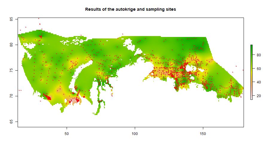
I have a set of data on the quantitative composition of the particle size distribution of the sedimentary layer. I have to build a map of the distribution of certain fractions across the entire study area.

I want to perform a kriging interpolation over the studied area. However, I have a question about the initial processing of the data set. I attach the map below with the distribution of the sampling points. I wonder if it is necessary to average some points that are very close to each other (especially in places with very dense sampling density)?

enter image description here

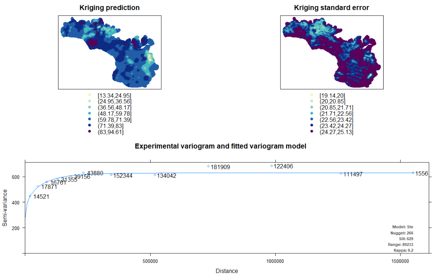
Just in case I attach the results of the kriging without any averaging. enter image description here
4
  • You're asking a couple of questions here that need treating separately 1) when to average nearby points, and 2) is this kriging okay? Can you please chop one of those questions out of this and create a new question.
    – Spacedman
    Commented Oct 20, 2019 at 16:08
  • Why don't the second two plots look like the same area as the first one?
    – Spacedman
    Commented Oct 20, 2019 at 22:57
  • Kriging could not be performed in the lon&lat crs. So, I had to transfer it to the metric system. The top plot in common wgs84 and the bottom plots in +proj=stere +lat_0=90 +lat_ts=70 +lon_0=-45 +k=1 +x_0=0 +y_0=0 +datum=WGS84 +units=m +no_defs Commented Oct 20, 2019 at 23:05
  • Averaging nearby points is throwing away information. Why would you want to do that? What's "wrong" with the kriging as it is already?
    – Spacedman
    Commented Oct 21, 2019 at 6:37

0

Browse other questions tagged or ask your own question.