0

I am looking for a similar solution to Making arrow from polygon centroid to point using QGIS but using ArcGIS Desktop.

I have a polygon and a point shapefile. The polygon area drains to the point node (This is a drainage node). The connectivity is coded in the attribute table name field in shapefile.

Now, I want to visually represent this connectivity using arrows from polygon to point. I also want this arrow indicator to be dynamic.

Meaning, any change in the attribute table reference will update the arrow connectivity. All these features are already available in QGIS. I want to replicate the same mechanism in ArcGIS Desktop.

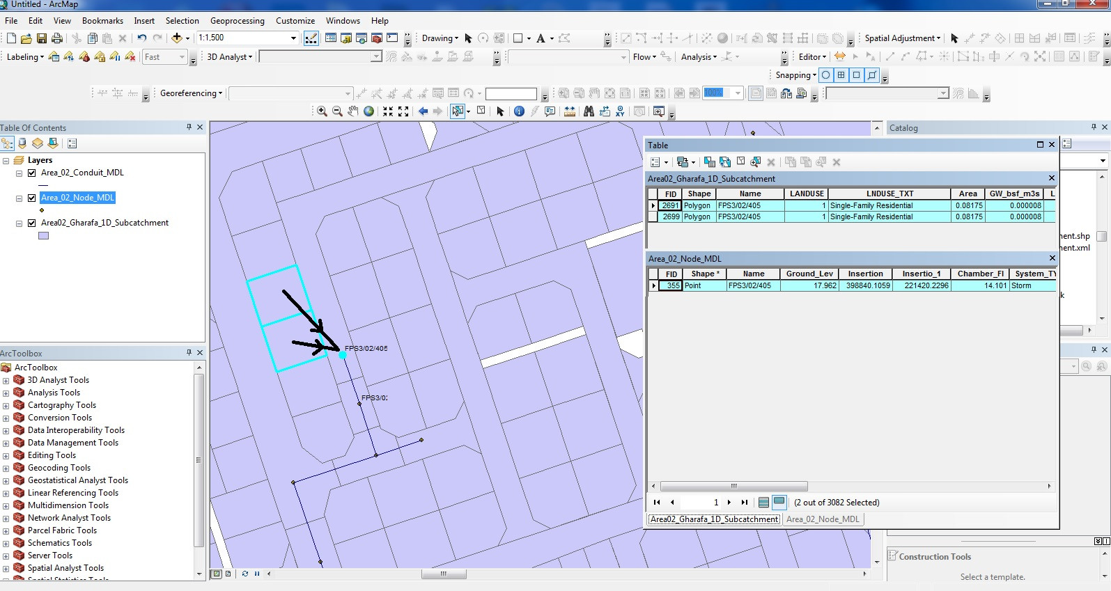
Shapefile attribute table structure and desired Arrow connectivity drawn

3
  • What do you mean by "the attribute table reference"?
    – PolyGeo
    Commented Oct 23, 2019 at 11:23
  • I mean, Any time I change the Polygon's connectivity node/ point in the 'Name' field at attribute table (of the polygon shape), the arrow will change from old node/ point to new one.
    – İmtiaz
    Commented Oct 23, 2019 at 12:35
  • 1
    I do not know of any dynamic display of geometry features based on a relation. You could do it with a python script that would refresh a featureclass. If you had editor tracking enabled the script could just replace the edited values. Forget shapefiles, they don't have tracking. You should be using a filegeodatabase anyway.
    – KimO
    Commented Oct 25, 2019 at 12:56

0

Your Answer

By clicking “Post Your Answer”, you agree to our terms of service and acknowledge you have read our privacy policy.

Browse other questions tagged or ask your own question.