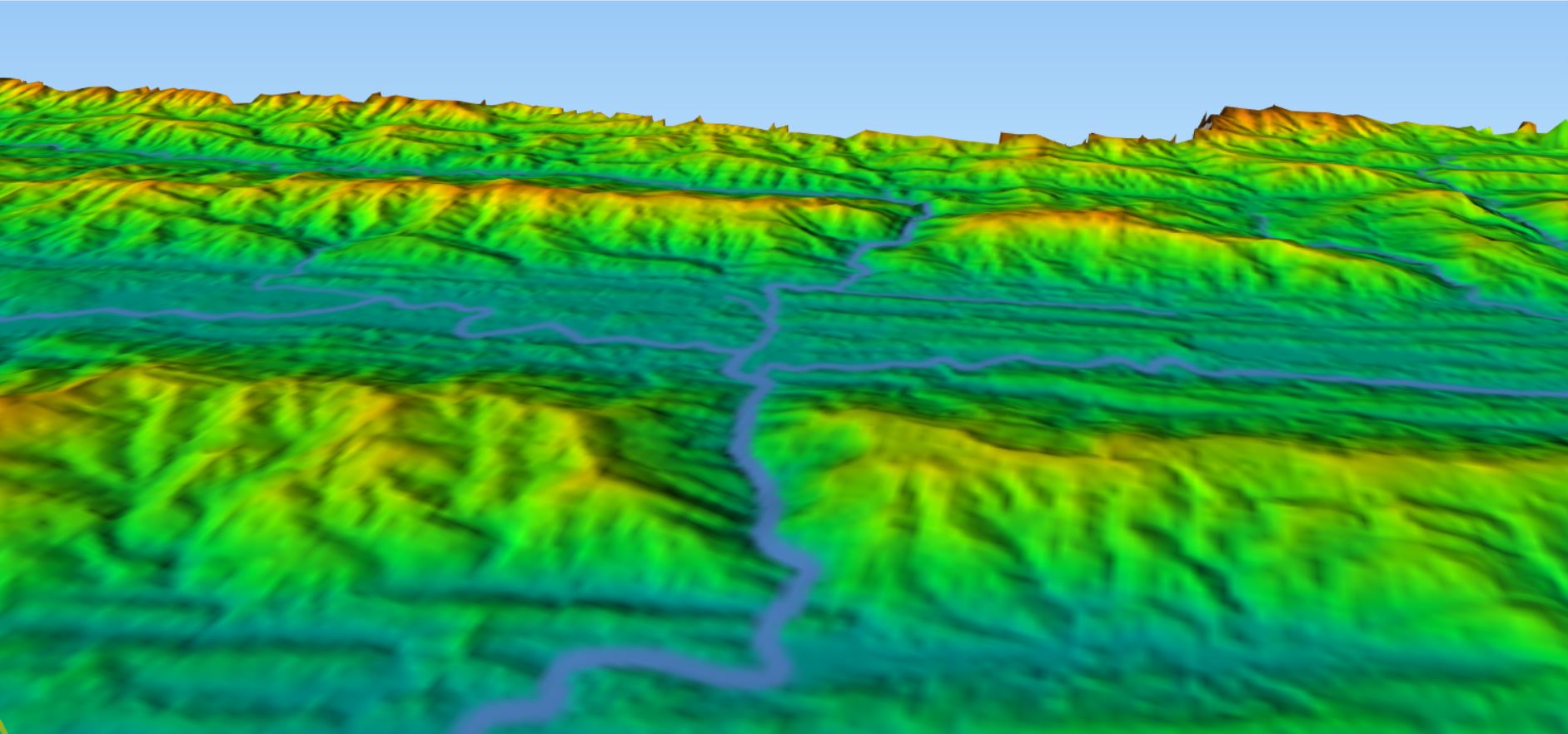
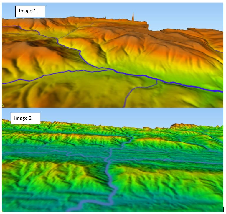
I have Two DEMs (Digital Elevation models)
- DEM (Image 1) - received from my institute
- DEM (Image 2) - downloaded from srtm
Both DEMs have been styled similarly. But DEM (Image 1) looks better than DEM (Image 2). The resolution of both the DEMs is also same that is 30m X 30m.

My question is why they look differently after doing same styling in qgis and how I can get such DEMs as in image 1.
My OneDrive link to download the images is https://1drv.ms/u/s!At3AD05XRRsNiFQRmp2KCiO1Mkmf?e=i6Owf9
