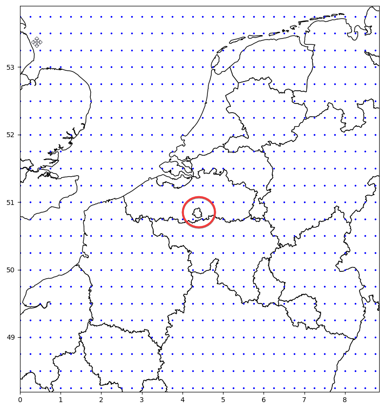
I have the following map of statistical regions of Belgium:
The blue dots correspond to coordinates for which I have temperature data. Surrounded by the red circle is Brussels. As it can be seen, there are no points inside Brussels and therefore I don't have temperature info for it.
I would like to assign the temperature in the closest blue point to Brussels. How could I find the closest point of the grid to the Brussels polygon using GeoPandas?

