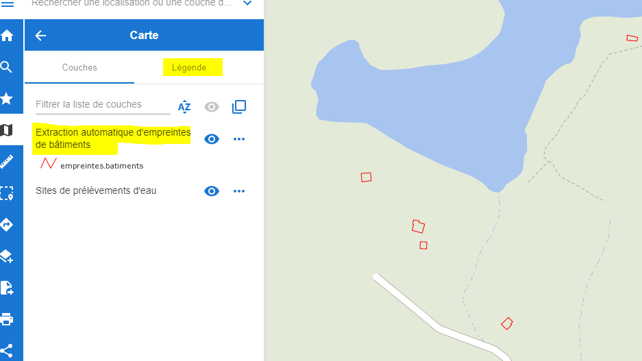
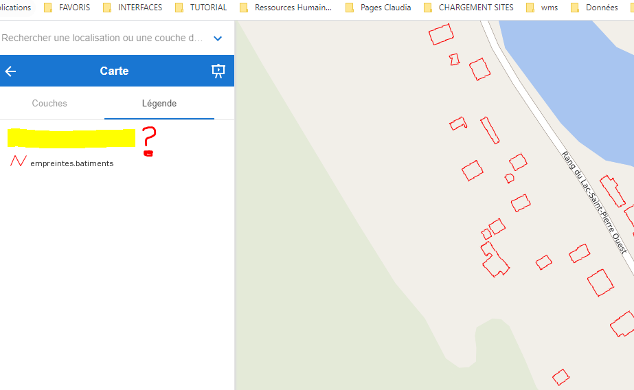
I have a problem with displaying the name of the layer in the legend of the user interface. I prepare the mapfile and I access with the WMS in my local test interface. When I add it to the user interface, the WMS appears but, the name of the layer does not appear in the caption. Here's my mapfile code
LAYER
    INCLUDE "../shared/ec/ec_getFeatureInfo.map"

    NAME "WMS"
    GROUP "Bâtiments"

    METADATA
        INCLUDE                 "../shared/ec/ec_meta_layer.map"
        "wms_group_title"       "Bâtiments"
        "wms_title"             "Extraction automatique d'empreintes de bâtiments"
        "wms_name"              "automatic_extraction_building_footprint_fr"
        "wms_server_version"    "1.3.0"
        "wms_format"            "image/png"
        "wms_dataurl_format"    "igo"
        "wms_dataurl_href"      "https://ouvert.canada.ca/data/fr/dataset/7a5cda52-c7df-427f-9ced-26f19a8a64d6"
        "wms_dataurl_format"    "text/html"
    END

    #MAXSCALE 10000000

    CONNECTION "http://cartes.geogratis.gc.ca/wms/automatic_extraction_building_footprint_fr?"
    CONNECTIONTYPE WMS
    TYPE RASTER

    PROJECTION
        "init=epsg:4269"
    END
END
- here the display of the WMS to test it on my local server, in the legend the name of the layer appears
However in the user interface, it does not appear.
There would be a lack of functionality in the mapfile for the name of the layer to appear in the legend?


