0

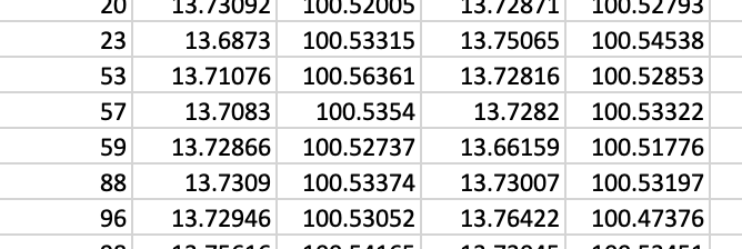
I have data that is XY coordinates (both origin and destination) in the CSV file. (example below, the last two-column is destination point)

enter image description here

Then, I want to count the number of points that start from polygon 1 (origin polygon) to polygon 2 (destination polygon) which is an administrative boundary.

I'm using ArcMap.

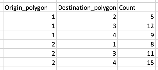
I would like to create a table like this below (just for example). enter image description here
3
  • Please share a sample of your CSV. It's hard to find out what you are trying to do. What have you tried so far? Commented Apr 23, 2021 at 7:37
  • If you wish to also ask about QGIS, ArcGIS Pro or another GIS software then please do so in separate questions.
    – PolyGeo
    Commented Apr 23, 2021 at 10:44
  • Please edit your question to include a couple of images of your polygon data and how your points plot on this. Also confirm what @PolyGeo is asking.
    – Hornbydd
    Commented Apr 23, 2021 at 13:35

0

Your Answer

By clicking “Post Your Answer”, you agree to our terms of service and acknowledge you have read our privacy policy.

Browse other questions tagged or ask your own question.