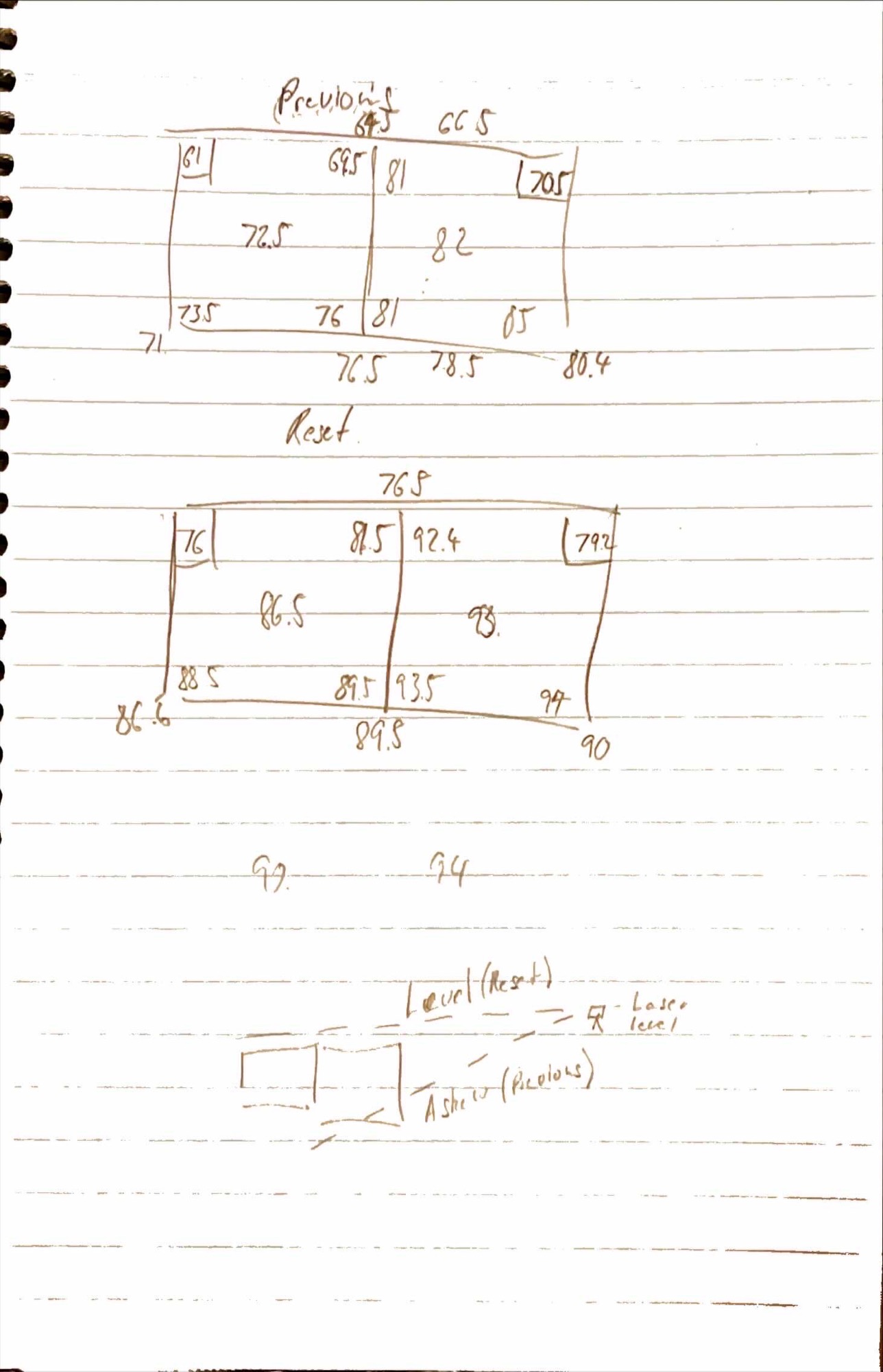
I was wondering if anyone could assist me with a problem. Undertaking some archaeological excavations we use a laser level as a datum to take heights or Z values, the laser level is free floating and creates a baseline level across the site. Horizontally we also have X and Y values off a string line. Together this creates X, Y, Z values that we use to take locations of various points in a 3 dimensional space. Unfortunately during the start of the excavation our laser level was locked and not free floating creating height values that were askew and more askew the further they are from the laser. We were able to collect the values of several heights from around our excavation squares before unlocking the laser and allowing it to float again and capturing the change in values.
I was hoping to use this data to correct the points taken prior to the laser being levelled properly using some sort of 3D transformation, maybe an affine transformation? Say using GIS, CAD or a similar program and under take the transformation of the points?
I have included an image below of the height values and a diagram of the issue.

