I feel like you might have a couple of questions in your question. For the question in your title, your don't provide enough information about your GIS or asset management system to answer.
However, I think this is a good question, but certainly not limited to asset management.
Do I now have to create a polygon
layer for my dams to be used with the
asset management system for viewing at
1:1,000 then a point layer for mapping
purposes when producing a map of the
same sites at 1:100,000?
Currently, we have both the building outlines and point features in our Esri geodatabases. We're just starting a Cityworks implementation, but it looks like the point features are what we are using to relate our tables to (since we maintain the point features but the building outlines are maintained by a different agency).
Having both the point and polygon geometries for the same feature isn't uncommon. For Esri geodatabases, these have to go into different featureclasses. You can't mix geometry types in Esri featureclasses (at least not in a way that is recognized by Esri software).
Update:
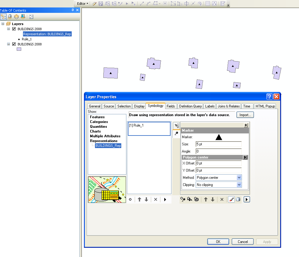
Since you are using an Esri geodatabase, you might be able to use cartographic representations. I haven't used them (until a minute ago), but it looks like it works. In my screen shot, I'm display 1 layer with the building cartographic representation and the 2nd layer with the actual feature geometry. If you apply the scale ranges, you can have buildings change from poly to point symbols as you zoom out. I will say that the user interface for cartographic reps feels less refined than the rest of ArcMap and ArcCatalog.


