2

When I use SAGA's Tool Topographic Position Index (TPI) or Tool TPI Based Landform Classification (in QGIS or SAGA itself) on a rectangular DEM the results are as expected but when I try them on a DEM with irregular borders I get the following result: Result of TPI on irregular DEM
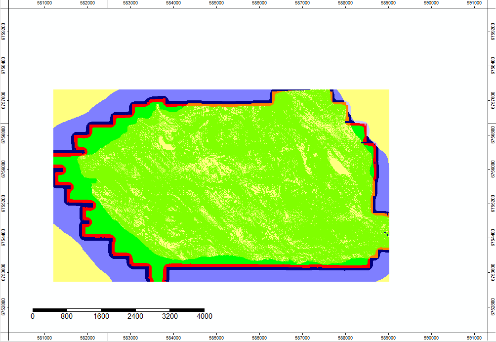
Is it possible to calculate TPI on this kind of DEM or do I need to subset it on multiple rectangular tiles?

1 Answer 1

3

I found another Question which gave me a hint on what the problem could be. SAGA recognize No Data values as -99999. Other values get processed as regular. I solved my problem reclassifying No Data values (which were being read as -3.4e+38) as -99999.

Your Answer

By clicking “Post Your Answer”, you agree to our terms of service and acknowledge you have read our privacy policy.

Not the answer you're looking for? Browse other questions tagged or ask your own question.