You can force:
GPX_USE_EXTENSIONS=YES
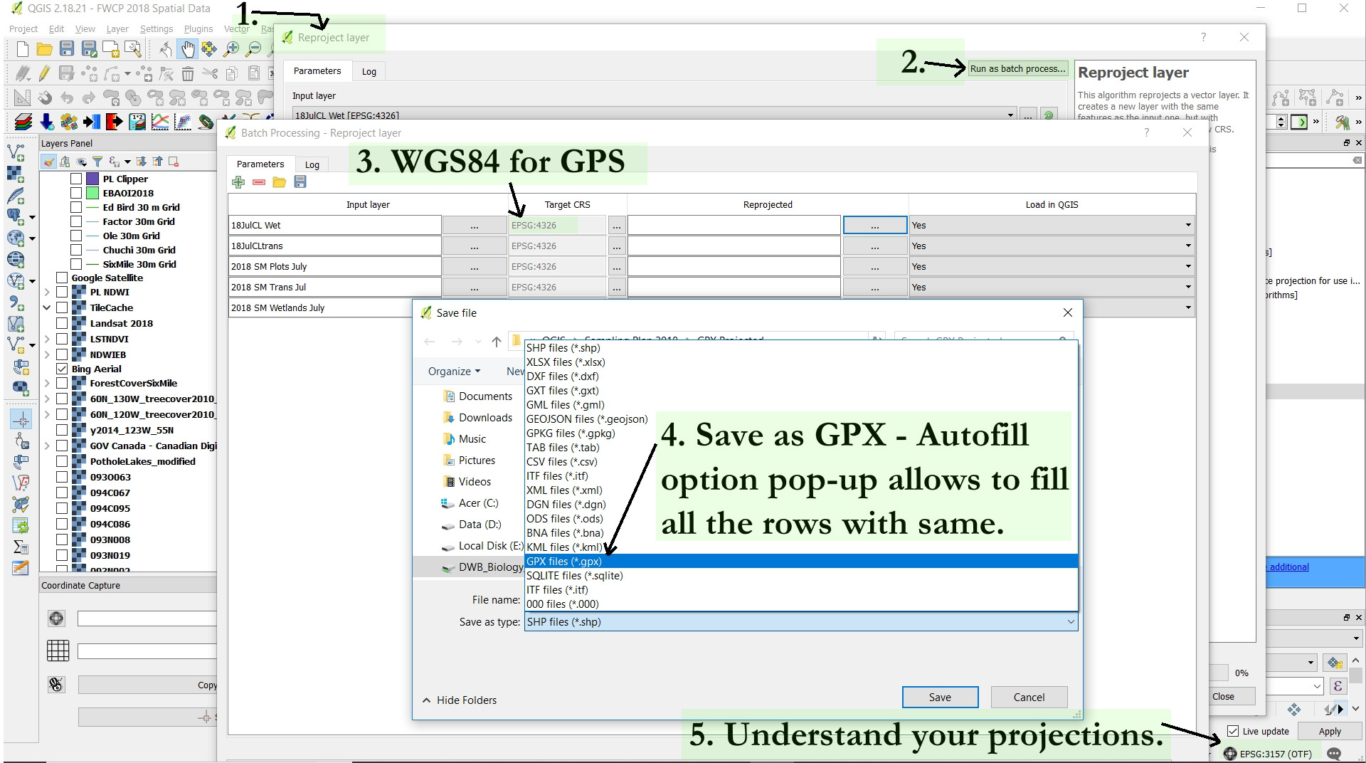
As indicated above. However, if you don't understand or manage your projections, then you will run into additional problems. You will find errors in the data - imprecision in the points or tracks if your CRS is different from what your shapefiles are projected in or how your workspace is projected; WGS84 is needed for GPS units.
The best solution I have found is to select "Reproject layer" from your processing toolbox. This gives you the option to batch convert multiple layers, reproject the data properly, and save as a gpx file.
The only issue that I haven't learned to solve is how to retain the labels. I'm hoping that someone might know how or have a trick to do this - it doesn't seem to be an option. I have had to either use the clunky Garmin BaseCamp software to click and revise the labels individually or go into the gpx code and type in the code manually - both are time consuming.


-skipfailuresinogr2ogrwithout researching why it's failing in the first place.