3

I try performing a multilevel spline interpolation from the SAGA tool but I get an error message.

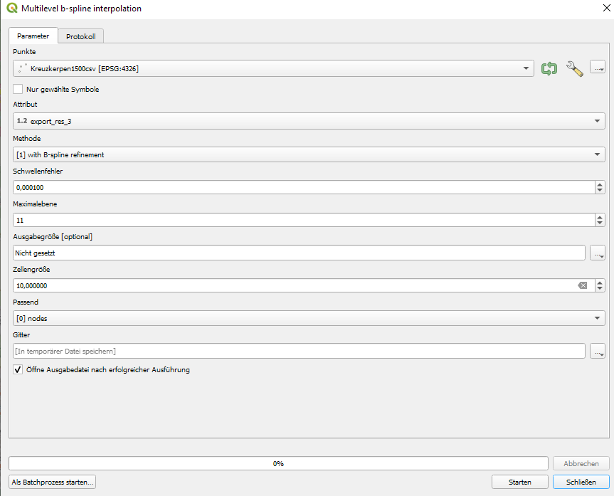
I have loaded a CSV consisting of 1500 points with latitude and longitude and elevation values. I'd like to interpolate the elevation with a spline method. However, I always get an error message and the protocol doesn't help at all.

The error in the protocol just says:

the following layer couldn't be added.

processing.run("saga:bsplineapproximation",{'SHAPES':'delimitedtext://file:///C:/Users/49151/Documents/Kreuzkerpen1500csv.csv?type=csv&skipEmptyFields=Yes&maxFields=10000&detectTypes=yes&xField=export_res_1&yField=export_res_2&crs=EPSG:4326&spatialIndex=yes&subsetIndex=yes&watchFile=no',
                                            'FIELD':'export_res_3',
                                            'LEVEL':1,
                                            'TARGET_USER_XMIN TARGET_USER_XMAX TARGET_USER_YMIN TARGET_USER_YMAX':None,
                                            'TARGET_USER_SIZE':100,
                                            'TARGET_USER_FITS':0,
                                            'TARGET_OUT_GRID':'TEMPORARY_OUTPUT'}
                                            )

here are my parameters

1
  • 1
    Please Edit the Question to contain the error message, as text.
    – Vince
    Commented Sep 9, 2021 at 13:27

1 Answer 1

2

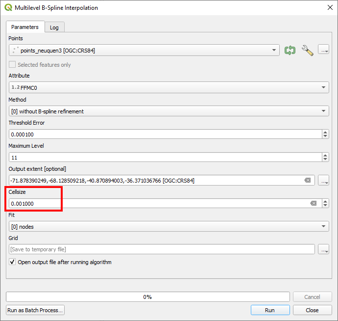
Issue is probably due to zellengröße (Cellsize) value if you are working with latitude and longitude expressed in degrees. For avoiding these errors, I used a value of 0.001 instead; as it can be observed in following image.

enter image description here

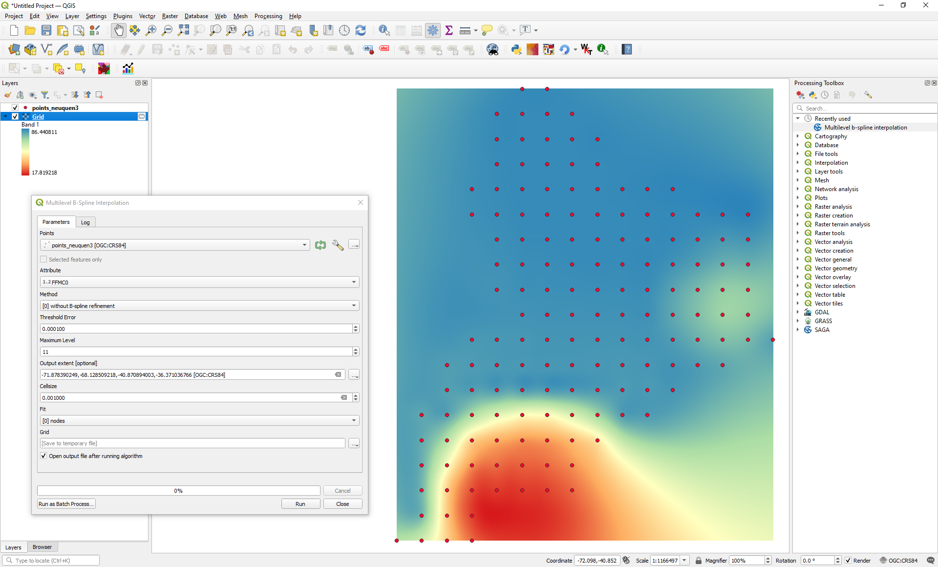
After click in Run, interpolation image was produced as expected (I only used 154 points but an error pop up when I used a value of 10).

enter image description here

Your Answer

By clicking “Post Your Answer”, you agree to our terms of service and acknowledge you have read our privacy policy.

Not the answer you're looking for? Browse other questions tagged or ask your own question.