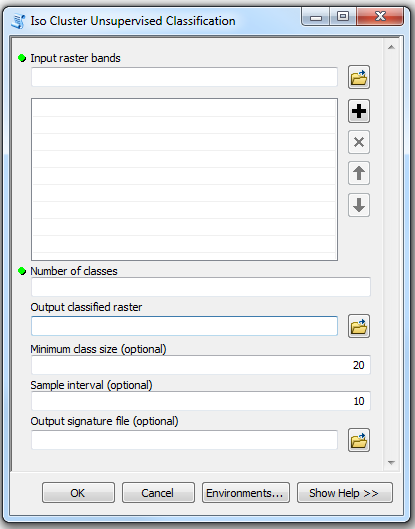
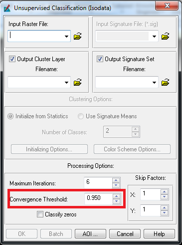
The ArcGIS tool Iso Cluster Unsupervised Classification does not seem to have any documentation on the convergence threshold used in the tool. To compare, Erdas Imagine has all of the necessary parameters displayed. How does ArcGIS determine the convergence threshold for their version of the ISODATA algorithm? More importantly, is there a way to set or override the convergence threshold in ArcGIS?


