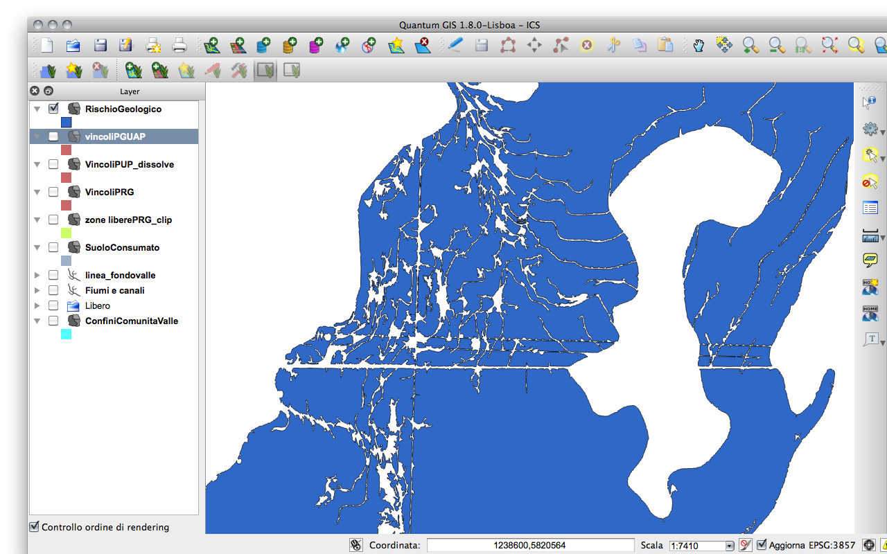
I have a raster layer from which I extracted only zones with a certain color, then polygonized it with QGis. I just generalized the new vector layer in GRASS to smooth things a bit.
There are many holes, "gulfs", "inlets" and cuts because the color zone in the raster overlays a black and white cartographic map. I would like to fill this spots, but I can't find a easy way. I already closed valid holes, but with "gulfs" and "inlets" I cannot use the same command.

In that image, only the hole on the right is suposed to exist. Is there a easy way to solve this?
